United States
›
Arizona
›
Organ Pipe Cactus National Monument

Best Hiking Trails in Organ Pipe Cactus National Monument

39 reviews


link Copy Link email Email directions Driving Directions

Seasonal Popularity

Overview

Organ Pipe Cactus National Monument is a national park in Arizona.


Resources

  • nps.gov
  • wikipedia

  • Hiking Trails (21)
  • Reviews (39)
  1. 1
    Organ Pipe Arch Canyon Hike
    ★ ★ ★ ★ ★ EASY 1.3 mi
  2. 2
    Group Camping Area via Palo Verde Trail
    ★ ★ ★ ★ ★ EASY 3.1 mi
  3. 3
    Baker-Milton Trail Loop
    ★ ★ ★ ★ ★ DIFFICULT 10.3 mi
  4. 4
    Dripping Springs Mine Trail
    ★ ★ ★ EASY 1.3 mi
  5. 5
    Victoria Mine To Lost Cabin Mine 1-Way
    ★ ★ ★ ★ ★ EASY 3.9 mi
  6. 6
    Sentia Basin Loop #3 Loop
    ★ ★ ★ ★ EASY 3.1 mi
  7. 7
    Group Camping Area via Red Tanks Trail and Victoria Mine Trail
    ★ ★ ★ ★ ★ MODERATE 6.8 mi
  8. 8
    Bull Pasture Spring Loop via Bull Pasture Trail and Estes Canyon Trail
    ★ ★ ★ ★ EASY 4.3 mi
  9. 9
    Group Camping Area via Desert View Trail
    ★ ★ ★ ★ EASY 1.8 mi
  10. 10
    Victoria Mine Trail
    ★ ★ ★ ★ EASY 4.5 mi
    user_profile
    JONATHAN CRIPE 4 months, 4 weeks ago
    Estes Canyon and Bull Pasture
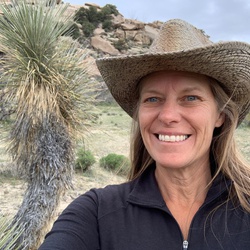
    A great loop! Hike through the Estes Canyon was fun to start with cacti all around and views of the cliffs in the distance. Bull Pasture Viewpoint had great views of Bull Pasture and also south to the border and Mexico. Originally had thought about trying to go up to Mount Ajo, but didn’t have enough time. Did some of the hike in that direction. Last 1/3 mile was loose and very steep. Not really worth going up if not going ash the way up to Mount Ajo. Gravel drive was fine with a sedan. Just made sure to drive slowly.
    ★ ★ ★ ★

    user_profile
    JONATHAN CRIPE 4 months, 4 weeks ago
    Ajo Arch
    Great hike up to the arch. First half of the trail was flat, but the second half was a fun scramble up to the arch. Great views across the monument and down to the border.
    ★ ★ ★ ★

    user_profile
    JONATHAN CRIPE 5 months ago
    Victoria Mine
    Quick hike to the mine ruins. Most interesting ruin was the foundations off a partially standing building. Saw a variety of cacti: organ pipe, saguaro, cholla, and ocatillo. Could see down to the border and a section of the border wall.
    ★ ★ ★ ★

    user_profile
    pmosfo 1 year, 9 months ago
    Bzzzzzz canyon
    Bzzzzzzzzzzzzzzz hisssss emhhhh bzzzzzzzzz
    ★ ★

    user_profile
    pmosfo 1 year, 9 months ago
    Track (8/23/24, 10:43:11)
    Very flat. Very hot, except when the clouds came out then it was a very manageable 95°. I would do this again, if I could figure out if the weird technological thing is a border patrol sensor or a scientific instrument. Brought the girlfriend along with her goofy backpack drink lots of water occasional PDA
    ★ ★ ★ ★ ★

    user_profile
    Roger Leischner 2 years, 2 months ago
    Track (3/29/24, 10:31:38AM)
    Nice to see the desert blooming
    ★ ★ ★ ★ ★

    user_profile
    Roger Leischner 2 years, 2 months ago
    Track (3/29/24, 10:31:38AM)
    Nice to see the desert blooming
    ★ ★ ★ ★ ★

    user_profile
    PBJ4theRoad 2 years, 2 months ago
    Victoria Mine Trail
    Gorgeous views through the tall saguaros all along this trail.
    ★ ★ ★ ★ ★

    user_profile
    PBJ4theRoad 2 years, 2 months ago
    Bull Pasture and Estes Canyon hike
    Gorgeous hike with beautiful views of the canyon and valleys below. For best views hike Estes Canyon then Bull Pasture. If knees are an issue, start with the steeper Bull Pasture then end with Estes Canyon.
    ★ ★ ★ ★ ★

    user_profile
    MnJBee 3 years, 3 months ago
    Desert View Clockwise.
    Nice hike with some climbing and close enough to the CG to walk without having to drive.
    ★ ★ ★ ★

    user_profile
    Bill Earl 4 years, 2 months ago
    Stop 9 via Ajo Mountain Drive
    This is a very good gravel bike ride. In March 2022, it wasn't too hot. But there is almost no shade so sun protection is important. There are a few steep and paved sections but it's mostly pretty easy gravel riding. The best stop for a break or lunch is at the Bull Pasture trailhead, where there are shade structures with picnic tables. For me, this was a combination of a scenic ride and one of my first outdoor rides of the year (training). It's worth noting that the ride from about the Arch Canyon trailhead back to the Visitor's Center is mostly downhill, making for a nice return after the long uphills.
    ★ ★ ★ ★

    user_profile
    Bill Earl 4 years, 2 months ago
    Victoria Mine Trailhead via Lost Cabin Mine Trail and Victoria Mine Trail
    This is a fairly easy hike for several reasons. The elevation change is minimal, the trail is extremely well maintained, and it's well marked. The ruins at the Victoria mine are maintained and worth seeing. There were about 15-20 people between the campground and the mine. No one between Victoria mine and the Lost Cabin. The selection and variety of cactus after the Victoria mine was outstanding. It's 8 miles round trip and well worth it if you have the stamina. Pick your season and weather with care.
    ★ ★ ★ ★

    user_profile
    ajcondo 4 years, 3 months ago
    Mt Ajo Summit
    Distance is one-way. Absolutely stunning hike. You’ll find rolling terrain for the first mile past Bull Pasture, then a steady to steep uphill until you reach the ridge line. Once on the ridge it’s rolling (and windy) approach to the summit. Absolutely stunning views the whole way and you’ll have them mostly to yourself. This hike is not publicized by the Park so most hikers turn around at Bull Pasture. The trail is clear and easy to follow. However, the steep parts aren’t supported with erosion proofing maintenance work. So, footing can be tricky unless you have good traction on your soles.
    ★ ★ ★ ★ ★

    user_profile
    SafeRidge7523 4 years, 5 months ago
    Desert View Loop - Organ Pipe Cactus NM
    Short but sweet! Little interpretive signs and great views!
    ★ ★ ★ ★ ★

    user_profile
    SimpleJetboil9012 5 years, 3 months ago
    Puerto Blanco Track
    4wd and hike through Organ Pipe NM. We did get a flat, so be prepared! Entire route is in great condition for any SUV. Spectacular vistas!
    ★ ★ ★ ★ ★

    user_profile
    MnJBee 6 years, 3 months ago
    Pali Verde Trail to OPNM visitor center.
    No driving day in Organ Pipe Cactus National Monument. Walked this trail from camp to visit the visitor center. Large variety of cactus and well maintained trail.
    ★ ★ ★ ★

    user_profile
    ClearIvy7336 6 years, 11 months ago
    Track (3/4/Dripping Springs 19, 7:32:47AM)
    I had wanted to hike to Dripping Springs without the drive around North Puerto Blanco Rd. Instead I started at the Pinkley picnic area on North Puerto Blanco Rd at the end of the 2 way Rd. The terrain was open and moderately easy. The spring was running and lush.
    ★ ★ ★ ★ ★

    user_profile
    Owens Adventures 1 year, 5 months ago
    Tuesday Morning Activity
    ★ ★ ★ ★ ★

    user_profile
    PBJ4theRoad 2 years, 2 months ago
    Baker Mine
    ★ ★ ★ ★

    user_profile
    PBJ4theRoad 2 years, 2 months ago
    Desert View Trail at sunset
    ★ ★ ★ ★ ★

    user_profile
    kids.nurse.77 2 years, 2 months ago
    Track (3/13/24, 15:17:20)
    ★ ★ ★ ★ ★

    user_profile
    DustyDusk7528 2 years, 6 months ago
    Natural Arch via Arch Canyon Trail
    ★ ★

    user_profile
    SnowyMtBoots1384 3 years, 1 month ago
    Milton Mine Baker Mine Loop
    ★ ★ ★ ★

    user_profile
    TallRose9019 3 years, 2 months ago
    Victoria/Lost Mine+ Trail
    ★ ★ ★ ★

    user_profile
    FrostyPrairie9304 3 years, 2 months ago
    Track (3/10/23, 10:00:30AM)
    ★ ★ ★ ★ ★

    user_profile
    PureXC-Ski6833 3 years, 2 months ago
    Track (3/2/23, 10:51:07AM)
    ★ ★ ★ ★

    user_profile
    DirectCompass1770 3 years, 3 months ago
    Track (2/21/23, 5:06:19PM)
    ★ ★ ★ ★ ★

    user_profile
    SharpIsland5633 3 years, 3 months ago
    Track (1/25/23, 12:09:04PM)
    ★ ★ ★ ★ ★

    user_profile
    BraveCliff8226 3 years, 4 months ago
    Bull Pasture Spring Loop via Bull Pasture Trail and Estes Canyon Trail
    ★ ★ ★ ★ ★

    user_profile
    YUByJWPO 3 years, 10 months ago
    Lukeville to Ajo
    ★ ★ ★ ★ ★

    user_profile
    SteepJuniper4208 4 years, 2 months ago
    Dripping Springs trail/pass
    ★ ★ ★ ★

    user_profile
    DustyCedar6995 4 years, 7 months ago
    Victoria Mine Trail
    ★ ★ ★ ★

    user_profile
    Melissa 5 years, 2 months ago
    Organ pipe cactus nm
    ★ ★ ★ ★ ★

    user_profile
    JovialRedwood3824 5 years, 4 months ago
    dog waste station to North Ajo Sonoita Highway, Pima County, AZ, USA
    ★ ★ ★ ★

    user_profile
    Kayson 5 years, 4 months ago
    Serita loop
    ★ ★ ★ ★ ★

    user_profile
    sabbene 6 years, 3 months ago
    Bates Well Road
    ★

    user_profile
    MildPalm1475 6 years, 3 months ago
    Track (1/25/20, 12:31:58PM)
    ★ ★ ★ ★

    user_profile
    MnJBee 6 years, 3 months ago
    Group Camping Area via Palo Verde Trail
    ★ ★ ★ ★