North Kaibab Trail and South Kaibab Trail
20.8 mi
Distance
7 hrs 48 min
Time
terrain
5,785 ft
Elev Gain
Overview
This is a difficult one way trail to Bridle Trailhead in Grand Canyon National Park.
This trail goes by South Kaibab Trailhead, Yaki Point, Ooh Aah Point, Cedar Ridge, O'Neill Butte, Skeleton Point, The Tipoff, Boat Beach, Bright Angel Campground, Cottonwood Campground, Redwall Bridge, Coconino Overlook, and North Kaibab Trailhead.
Sights to See
Rate this Hike
★★★★★

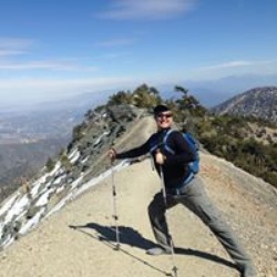
Solo backpacked Tues 2/18/25 – Started really early down the icy South Kaibab Trail with more than half a moon shining down from a clear star-filled sky. The ice and snow disappeared after 15 minutes, right before I met up with 2 bighorn ewes taking a more direct route down. Thankfully for us humans, the trail was in good shape all the way down to the river, although still a constant orthopedic workout with the numerous log and stone steps. After going through the tunnel and crossing the Kaibab suspension Bridge, I was really looking forward to the uphill climb on the North Kaibab Trail. I took a break at the Phantom Boat Beach water station and was glad to find it in working order for filling up later on the return trip. Just before it was light enough to turn off my headlamp, I met up with the first people of the day at Phantom Ranch, the trans-canyon water pipeline crew and then a ranger. While Phantom Ranch was closed to the public, it was housing the crew and the trail detoured around a temporary pipe-filled construction yard. After the ranger checked my permit and answered a few questions, I was on my way, soon passing several mule deer that seemed to be waiting for breakfast near the kitchen facility. From here to Cottonwood Campground, the trail wound its way north through Phantom Canyon, alongside Bright Angel Creek, crossing it several times via steel mule bridges. This trail segment is a low-pitched, steady climb with the towering walls and rock formations offering a steady change in scenery with the sound of a well flowing creek for most of the way. After the trail passes the Ribbon Falls junctions, it meanders a bit to prolong the last stretch before the Cottonwood trees at the camp come into view. The campsites at Cottonwood were nice, each one having at least two fairly level tent pads, a picnic table and food storage box. As others have said, the easiest place to filter water from Bright Angel Creek is just behind the ranger station which the trail passes first before the numbered campsites. The bathroom facility across from the ranger station was one of the cleanest I’ve used on any trail. Headed back to my campsite after filtering water, I met the only other person coming in to Cottonwood for the night (there was already one other party in a group campsite. Nice views of Oza Butte, and Bright Angel-Manzanita points from the campground. Always thankful for great weather and this trip had it for the duration. Logged 15.1 miles / 1851 ft ascent, 5012 ft descent with Gaia ................................................................................................................................................................................... Solo backpacked Weds 2/19/25 – Started really early on the North Kaibab Trail with a spectacular star-filled sky, hoping to see the sunrise from the North Rim while trekking on firm snow and it worked out nicely. Another treat was moonlit Roaring Springs cascading down the canyon wall, just after the Manzanita Rest Area (water was on). There were several icy trail sections with significant exposure (dark abysses) on the way up that required a little extra focus but no real snow cover until reaching the Supai Tunnel. From here, the snow steadily deepened but remained firm, making for an enjoyable hike through it. With a few 100 vertical feet to go to reach the North Rim, cold wind gusts started blowing across the switchbacks, decreasing the wind chill so much that I had to stop and put on a second jacket and heavier weight gloves before continuing. Shortly after this, I was able to see a nice sunrise from the Coconino Overlook before finishing the final switchbacks leading to the North Kaibab Trailhead kiosks. The North Rim was quite a contrast to the South with a deep blanket of snow covering the roads and trees and very quiet with only the normal sounds of a forest. After a short break, I headed back down past the horseshoe post, stopping at Coconino a second time to enjoy one of the best views on the North Kaibab Trail. While heading back down to Cottonwood Camp, it warmed up quickly to a very pleasant temperature with no wind and sunny skies. Aside from the interesting landscapes and rock formations, it was neat to see the remnants of the 1935 Trans-Canyon Telephone lines and poles paralleling the trail and Bright Angel Creek. Just before arriving back at Cottonwood Camp, there is a nice, distant view of the South Rim to remind you of the uphill climb out that awaits! There was still plenty of time left in the day for a nice lunch and climbing around the Manzanita Point area. Later, while I was eating dinner, the deer moved into camp to forage in the revegetation project area for a while, simply ignoring the “keep out” signs while a few well fed Kaibab squirrels kept a close eye on my food. Another great day in the canyon. Logged 14.3 miles / 4308 ft ascent, 4306 ft descent with Gaia .................................................................................................................................................................................................................................. Solo backpacked Thurs 2/20/25 – For no particular reason, the climb back to the South Rim seemed easier than anticipated. I was in no hurry to leave the canyon but I was well rested and psyched up to see the Colorado River and South Kaibab in daylight since I had descended that part of the route in total darkness. My goal was to reach Phantom Ranch at day break but I arrived half an hour early so I stopped at the Phantom Boat Beach water station and had some food. After taking a few pictures of the Kaibab Suspension Bridge and the Bright Angel Pueblo site, I crossed the bridge and started the climb out. While I was viewing the river, a helicopter came around the river bend, flying just high enough to clear Silver Bridge before landing at Phantom Ranch which must have been very scenic ride up the river for everyone aboard on such a nice morning. Twenty minutes into the South Kaibab trail climb, the views of the canyon and the river really started to open up in spectacular fashion. Most of the temples, mesas and buttes had picture perfect morning lighting to warrant constant picture taking. Right before reaching The Tipoff, I spotted and climbed up to a cross on a sub peak just off the trail that was made from a 1935 Trans-Canyon Telephone pole. There were no identifying markers or signs regarding its significance so it remains a mystery. The panoramic views from The Tipoff, Skeleton Point, Cedar Ridge and Ooh-Ah Point were really far reaching in such great weather. Once at Cedar Ridge, I started meeting up with hiking groups coming down with several stopping to ask about the trip. A little further up, people started warmly congratulating me before asking about distances and destinations, something that I don’t often experience which was really nice. It’s the sort of thing that truly restores your faith in humanity these days. After reaching the South Kaibab Trailhead just before noon, it was hard to believe the trek was over but then I knew I would be back shortly for the Escalante Route! Logged 14.6 miles / 4862 ft ascent, 1714 ft descent with Gaia
★
★
★
★
★


Public Tracks

R2R
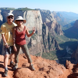
Robert and me
South Kaibab (SR) to North Kaibab (NR)
Osc dropped us off at rt 64 intersection with road for S Kaibab TH
~4:20amstart from car drop off
4:35am start from TH finished 4:45pm to Oscar’s happy face
Robert had tough time on way down. Took time to get him back to life and he was fine rest is hike.
Made it to PR by 8:15am
Spent 30m there - drinking lemonade and ate lunch
Cottonwood campground by 12noon - long and hot! We were lucky the day was relatively cool cuz it was still hot
Manzanita by 1pm
5 mi out from manzanita were long, up and hard
Rained 1/2 way through
Felt like we were trudging - walking dead.
Sooooo glad to see Oscar and to reach the car quickly. We were exhausted

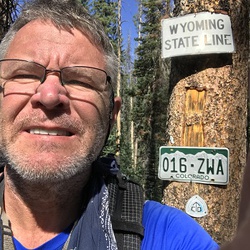
N. Rim to S. Rim
Cade Ottley, Jeff & Tami Reeder, Vali & Wayndon Veater

Grand Canyon National Park Hike
https://connect.garmin.com/modern/activity/19157769556


 stars
stars