meta

Bishop Pass

based on 223 tracks & routes #1 hike out of 602 in
10.5 mi
Distance
5 hrs 15 min
Time
terrain
2,162 ft
Elev Gain

Overview

This is a difficult out and back trail to Bishop Pass in Inyo National Forest.

This trail goes by Chocolate Peak.

Getting Started

Turn on West Line street in Bishop CA and follow signage taking you to South Lake. You will dead end at a large parking lot with beautiful South Lake to welcome you. Trail head is visible with amazing views of South Lake while hiking up the trail. Trail will split about a mile, the other trail takes you to Treasure Lakes but stay on the Bishop Pass trail. Continue on the main trail, you will see beautiful lakes as you go by. The final lakes will be the Bishop Lakes before ascending the switch backs taking you to Bishop Pass. Snow fields will be present in the summer and are passable but be careful while hiking over snow fields. The terrain is rough but worth it as you make it to the Bishop Pass marker.

Taking Children

Not recommended for children under the age of 12 unless they are able to hike difficult and long trails. I rate this trail a 1 due to the length of the hike and the terrain through out the switch backs.


    Rate this Hike

    user_profile
    2 years, 1 month ago
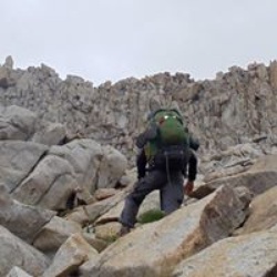
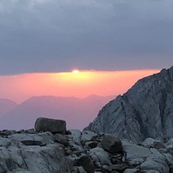
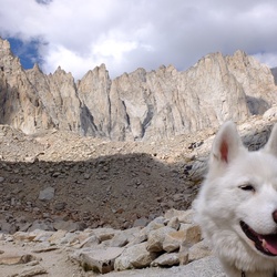
    Solo day hiked Fri 10/20/2023 – Spent the night at Forks campground and was lucky enough to see the Orionid meteor shower. Early hike out to Ruwau Lake and then up the north face of Picture Puzzle. Went too far west and was climbing class 4 too early so back east (towards Cloudripper) and up the bigger north chute talus field to the right of the snow. Crossed to the left side of the chute near the top of the ridge and ran into a flock of mountain chickadees picking through the snow. The talus was fun to climb but more unstable than even Agassiz with some of the largest boulders frequently moving in spite of careful hold placement/testing. The few sliding scree sections were ridiculous to cross but the snow was good and the ice not too bad. Took the ledges around the pinnacles and climbed up the last one just north of the summit notch. Descended down to the NE couloir /notch after trying a few different routes and took off my pack for the last summit climb. Found 2 great chimneys that started from a point 30 feet down the notch’s west chute to start up the real summit which was a much easier ascent than what it looked like from the notch. Views from the summit were spectacular with the wind just starting up. Summit register was an empty water bottle with a note pad and a golf tee but no pen. The down climb was long and uneventful until a 3 x 4 boulder dislodged and rolled about 50 feet downward which added some real excitement and had me snugging my helmet straps. Got back to Ruwau Lake and hiked up Chocolate Peak which was well worth the views from the top. Took the Chocolate Lakes Loop back to Bishop Pass to finish off another day of awesome hiking/climbing weather. Highly recommend Picture Puzzle for the scramble/climb/views and Chocolate Peaks for the hike/views. Logged 10.5 miles/4103 vertical ft. with Gaia ......................................................................................................................................................................................... Solo hiked Thurs 10/5/2023 – Plenty of shooting stars on the way to Agassiz with a bright moon. Early start snow climbing the first 1500 ft. of Mt. Agassiz R/H west chute with axe and crampons until the snow wouldn’t hold. Then on to the SW rocks/slabs to the summit which was great fun and fast, good holds even with some ice and more snow from last week than I planned on. Spent an hour taking in the incredible views from the summit before heading down. Since the snow in the chute was unstable/unconsolidated with a few 1 foot diameter pinwheels mid slope and the warming weather, I decided not to descend on it. And so the rock down climbing trek began with choosing the steepest slope to right of the chute to try and make it down faster (larger down steps). It was fun for the first 1000 feet but just tiring for the last 1000. I would recommend waiting for either winter climbing snow or dry rocks as the snow and ice on the rocks dragged out a simple down climb. Couldn't resist trying to glissade the last 200 feet but the snow was too soft. Went out south past Bishop Pass to a Dusy Basin overlook to recover with an 1-1/2 hour lunchbreak before heading down to Bull Lake for another stop to enjoy perfect October weather for a bit. Longer day than I planned on but really enjoyed the trail on the way out. If you decide to go up the Agassiz, it needs a new summit canister as the current one is a cracked plastic container that was full of snow. I let the note pad dry for an hour before putting it in a few vented zip lock bags I had but the canister is useless. Logged 13.7 miles/4139 vertical ft. with Gaia
    ★ ★ ★ ★ ★

    user_profile
    1 year, 5 months ago
    ★ ★ ★ ★ ★

    user_profile
    4 years, 1 month ago
    ★ ★ ★ ★ ★

    user_profile
    4 years, 3 months ago
    ★ ★ ★ ★ ★

    user_profile
    4 years, 4 months ago
    ★ ★ ★ ★ ★


Public Tracks

user_profile
GentleBrook6121 5 months ago
Bishop Area Trails Hike
https://connect.garmin.com/modern/activity/19594148309
user_profile
forest_floor 8 years, 5 months ago
Bishop Pass trail
Resupply via Bishop Pass trail
user_profile
Juya Ghanaie 6 years, 4 months ago
Track (9/13/17, 10:18:40AM)
Agassiz to south lake
user_profile
Mark Venner 6 years, 8 months ago
RSY01
Resuply
user_profile
Stephen Lau 7 years, 1 month ago
RSY01
Resuply
user_profile
Mustafa Veziroglu 7 years, 8 months ago
RSY01
Resuply
user_profile
Alan Stringer 8 years, 6 months ago
RSY01
Resuply
user_profile
Steve McClure 9 years, 5 months ago
user_profile
cvanart2 2 months, 1 week ago
user_profile
OldTrek2890 2 months, 3 weeks ago
user_profile
ChillyRaft3576 2 months, 3 weeks ago
user_profile
Peggy 3 months, 2 weeks ago
user_profile
Scott Morris 3 months, 3 weeks ago
user_profile
Lori Gable 4 months, 1 week ago
user_profile
TallPlateau6670 4 months, 1 week ago
user_profile
nanstern 4 months, 3 weeks ago
user_profile
David Reynoso 4 months, 3 weeks ago
user_profile
Mike Roberts 5 months, 2 weeks ago
user_profile
Seth Dunn 5 months, 2 weeks ago
user_profile
FreeCave6574 1 year, 2 months ago
user_profile
NobleStorm3156 1 year, 3 months ago
user_profile
GentleHolly9968 4 years, 3 months ago
user_profile
RoughGaze1033 5 years, 3 months ago
user_profile
CozyWetland6958 5 years, 5 months ago
user_profile stars
TallCave1921 6 years, 2 months ago
user_profile
ShadyMoss9981 6 years, 2 months ago
user_profile
RichDawn5179 6 years, 2 months ago
user_profile
Theresa Carson 6 years, 3 months ago
user_profile
Theresa Carson 6 years, 3 months ago
user_profile
HumidFir3869 6 years, 3 months ago
user_profile
EarlyTorch3415 6 years, 3 months ago
user_profile
boxkarw 6 years, 4 months ago
user_profile
Troy Corliss 6 years, 4 months ago
user_profile
SlimRun1332 6 years, 5 months ago
user_profile
FLZq0ljN 6 years, 5 months ago
user_profile
SlowBasin1852 6 years, 7 months ago
user_profile
ToughIsland9431 7 years, 7 months ago
user_profile
ToughIsland9431 7 years, 7 months ago
user_profile
SafeGlide9885 8 years, 4 months ago
user_profile
Daniel Albers 8 years, 4 months ago
user_profile
Erin Clerico 9 years, 1 month ago
user_profile
LittleTerrace6754 10 years, 3 months ago
user_profile
SassyTent4196 10 years, 9 months ago