United States
›
Arkansas
›
Buffalo National River
›
County Road 14

County Road 14(edit)

based on 69 tracks & routes   |   |  
MODERATE
   #23 hike out of 27 in Buffalo National River   |   
MODERATE
link Copy Link email Email directions Driving Directions
  • GPX
  • KML

6.8 mi
Distance

4 hrs 6 min
Time
terrain
345 ft
Elev Gain

Overview

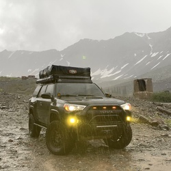
This is a moderate one way trail in Buffalo National River.


    Rate this Hike

    ★★★★★


Public Tracks

user_profile
Kris Rasmussen 7 years, 5 months ago
Line 9
user_profile
EpicMap1916 7 years, 6 months ago
Line 9
user_profile
RockyLake4224 7 years, 8 months ago
Line 23
user_profile
Jeremy Rash 11 years, 2 months ago
oot 4

Elevation Profile

Seasonal Popularity

Nearby Hiking Trails

  1. Robertson Hill via Buffalo River Trail - OHT
    ★ ★ ★ ★ ★ DIFFICULT 13.5 mi
  2. Pine Knob via Ozark Highlands Trail
    ★ ★ ★ ★ ★ DIFFICULT 20.1 mi
  3. Tyler Bend Visitor Center via Spring Hollow Trail
    ★ ★ ★ ★ EASY 1.5 mi
  4. County Road 281
    ★ ★ ★ ★ EASY 1.3 mi
  5. Hike to Nars
    ★ ★ ★ EASY 4.2 mi
  6. Robertson Hill via County Road 14
    ★ ★ ★ DIFFICULT 11.2 mi
  7. Peter Cave Road
    ★ ★ ★ EASY 2.3 mi
  8. US 65
    ★ ★ DIFFICULT 26.5 mi
  9. County Road 252 and County Road 13
    ★ ★ ★ EASY 1.8 mi
  10. Blue Bird Drive and County Road 33
    ★ ★ ★ DIFFICULT 9.1 mi