United States
›
Utah
›
Uinta-Wasatch-Cache National Forest
›
Bunchgrass Trailhead via Bunchgrass

Bunchgrass Trailhead via Bunchgrass(edit)

based on 5 tracks & routes   |   |  
DIFFICULT
  
DIFFICULT
link Copy Link email Email directions Driving Directions
  • GPX
  • KML

11.6 mi
Distance

6 hrs 53 min
Time
terrain
2,523 ft
Elev Gain

Overview

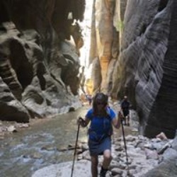
This is a moderate one way trail to Bunchgrass Trailhead in Uinta-Wasatch-Cache National Forest.


    Rate this Hike

    ★★★★★


Public Tracks

user_profile
mSPzVu2l 1 year, 6 months ago
Sunday Afternoon Mountain Biking
user_profile
Janet Parker 6 years, 8 months ago
Tony Grove to White Pine to Bunch Grass
user_profile
FitWild7568 9 years, 7 months ago
Track (10/1/16, 9:07:50AM)

Elevation Profile

Seasonal Popularity

Nearby Hiking Trails

  1. White Pine Lake
    ★ ★ ★ ★ ★ DIFFICULT 8.4 mi
  2. High Creek Lake
    ★ ★ ★ ★ ★ DIFFICULT 10.6 mi
  3. 014 Loop via Mt Naomi Peak N.R.T.
    ★ ★ ★ MODERATE 6.6 mi
  4. White Pine Lake
    ★ ★ ★ ★ DIFFICULT 10.5 mi
  5. Naomi Peak Trail
    ★ ★ ★ ★ MODERATE 4.1 mi
  6. Steam Mill Lake
    ★ ★ ★ ★ MODERATE 4.8 mi
  7. Steam Mill
    ★ ★ ★ MODERATE 6.5 mi
  8. 015 via Blind Hollow Trail
    ★ ★ ★ MODERATE 6.4 mi
  9. White Pine Lake
    ★ ★ ★ DIFFICULT 16.1 mi
  10. Peter Sinks via Forest Road 56
    ★ ★ ★ DIFFICULT 18.0 mi