Wind Mountain
Overview
This trail is an out-and-back just outside of Stevenson,WA. It is moderately difficult as there is significant elevation gain over a short distance (~1.3mi one way). The top of this trail provides you with a nice rock garden to rest and take in the sweeping views of the Columbia River Gorge and neighboring mountains.
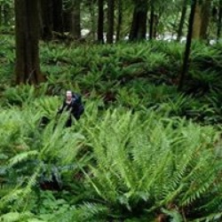
The hike up Wind Mountain in the Columbia River Gorge is a switchbacking ascent to an unusual peak. It is believed to be a microdioritic intrusion into the Columbia River Basalts, potentially part of the same structure as Shellrock Mountain. The trail is easily spotted on the south side of the road and gradually gains elevation. Along the way, there is a spur trail leading to a scenic viewpoint with views of Dog Mountain and Augspurger Mountain. As you continue climbing, the trail levels out in a forested area near the summit. A large sign describes the cultural and historical significance of the mountain as a spirit quest site and mentions that certain sections of the summit are closed to hikers due to their fragility.
Upon reaching the summit, designated viewing areas offer spectacular vistas to the east and west. The eastern view provides a perspective of Dog Mountain and Mitchell Point across the Columbia River, as well as Mount Defiance in the distance. Looking west down the Columbia River Gorge, notable landmarks such as Indian Point, Table Mountain, Greenleaf Peak, and on clear days, Mount Saint Helens to the northwest, can be seen. It's important to respect the closures and signage at the summit, as parts of Wind Mountain hold cultural significance to Native Americans.
Getting Started
Parking is available at the TOP of Wind Mountain Rd. (do not go down the hill to where the trailhead is). From the parking lot head down the hill, and you will see the trailhead kiosk on your right.
Drive I-84 east to Exit 44 for Cascade Locks and Stevenson.
After 0.4 miles, bear right for the Bridge of the Gods and Stevenson.
Driving over the bridge for 0.7 miles, turn right on Highway 14E for Stevenson and Kennewick.
Drive 8.9 miles through Stevenson and Home Valley and turn left on Wind Mountain Road.
Go up this road for 1.5 miles, and then make a right onto Girl Scout Road for the Wind Mountain Trailhead.
Drive 0.3 miles, passing a large open space at a quarry and heading downhill on a narrow gravel road to a couple of small pullout areas on the left across from the trailhead. If these are occupied, go back to the quarry area and park.
Taking Children
(5/10): This hike can be grueling. If you are wanting to get a workout in with your kids, I'd say do it, but be aware that it can be difficult especially in inclement weather.
Sights to See
Rate this Hike
★★★★★


Public Tracks


 stars
stars


 stars
stars