United States
›
South Dakota
›
Black Hills National Forest
›
Beaver Creek Road and Rankin Ridge Road

Beaver Creek Road and Rankin Ridge Road(edit)

based on 28 tracks & routes   |   |  
MODERATE
   #4 hike out of 5 in Black Hills National Forest   |   
MODERATE
link Copy Link email Email directions Driving Directions
  • GPX
  • KML

5.4 mi
Distance

3 hrs 18 min
Time
terrain
358 ft
Elev Gain

Overview

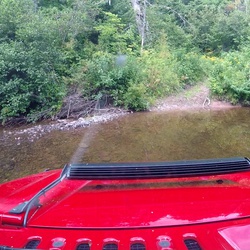
This is a moderate one way trail in Black Hills National Forest.


    Rate this Hike

    ★★★★★


Public Tracks

user_profile
alwaysdifferent 5 years, 3 months ago
CTY-391
user_profile
Mark Fluegel 7 years, 3 months ago
CTY-391
user_profile
ChillyFern8609 7 years, 11 months ago
CTY-391

Elevation Profile

Seasonal Popularity

Nearby Hiking Trails

  1. Pullout Loop via Lookout Point Trail and Centennial Trail #89
    ★ ★ ★ EASY 4.6 mi
  2. National Forest Road 374 - Nihart
    ★ ★ ★ ★ ★ EASY 1.9 mi
  3. Black Hills National Forest Hike
    ★ ★ ★ ★ ★ EASY 2.7 mi
  4. Sylvan Lake Campground via SD 87
    ★ ★ ★ ★ DIFFICULT 38.5 mi
  5. Sylvan Lake Campground via State Highway 87 and SD 87
    ★ ★ ★ ★ ★ DIFFICULT 38.6 mi
  6. Highland Ridge Road and Red Valley Road
    ★ ★ ★ DIFFICULT 10.9 mi
  7. Pringle Trailhead via CR 315
    ★ ★ ★ ★ EASY 4.1 mi
  8. National Forest Road 336.1l - Flynn Creek Br 1l
    ★ ★ ★ ★ EASY 1.3 mi
  9. Black Hills National Forest Hike
    ★ ★ ★ ★ EASY 3.1 mi
  10. Black Hills National Forest Hike
    ★ ★ ★ ★ EASY 1.7 mi