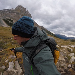
Canada
›
Alberta
›
Don Getty Wildland Provincial Park
›
Mount Bryant Route

Mount Bryant Route(edit)

based on 35 tracks & routes   |   |  
EASY
   #14 hike out of 34 in Don Getty Wildland Provincial Park   |   
EASY
link Copy Link
  • facebookFacebook
  • Twitter iconTwitter
  • emailEmail
directions Driving Directions
  • GPX
  • KML

4.4 mi
Distance

2 hrs 19 min
Time
terrain
1,276 ft
Elev Gain

Overview

This is a easy one way trail in Don Getty Wildland Provincial Park.


    Rate this Hike

    ★★★★★


Public Tracks

user_profile
NeluGoia 4 years, 10 months ago
Mount Bryant
user_profile
TCRF 5 years, 8 months ago
Mount Bryant (BS)

Elevation Profile

Seasonal Popularity

Nearby Hiking Trails

  1. 1
    Wasootch Ridge
    ★ ★ ★ ★ ★ MODERATE 4.1 mi
  2. 2
    Elbow River Loop via Prairie Creek Trail and Powderface Creek Trail
    ★ ★ ★ ★ ★ DIFFICULT 12.7 mi
  3. 3
    Jumpingpound Mountain Loop via Powderface Trail
    ★ ★ ★ ★ ★ DIFFICULT 18.1 mi
  4. 4
    Powderface Trail
    ★ ★ ★ ★ ★ DIFFICULT 21.9 mi
  5. 5
    Wasootch Ridge Loop
    ★ ★ ★ ★ ★ DIFFICULT 9.0 mi
  6. 6
    Nihahi Ridge
    ★ ★ ★ MODERATE 2.8 mi
  7. 7
    Compression Ridge Loop
    ★ ★ ★ ★ DIFFICULT 10.0 mi
  8. 8
    Jumpingpound Mountain
    ★ ★ ★ EASY 3.9 mi
  9. 9
    Mount Howard Loop
    ★ ★ ★ DIFFICULT 12.3 mi
  10. 10
    Cox Hill
    ★ ★ DIFFICULT 11.4 mi
  • Web App

    • Map
    • Find Trails
    • Upload
  • Resources

    • Hiking & Backpacking
    • Offroad
    • Hunting
    • Mountain Biking
    • Backcountry Skiing
    • Fishing
    • Map Catalog
    • Help & Forums
  • Purchase

    • Individuals
    • Professional
    • Outside+
    • Volunteer
    • Gifts
  • Company

    • Blog
    • Podcast
    • Jobs
    • Diversity
    • Partnerships
    • Media
  • Gaia GPS - Trail maps for every adventure

    Follow Us

    Download on the App Store Get it on Google Play

© Trailbehind Inc. - All Rights Reserved.

  Privacy • Terms

Outside Inc Logo

© 2022 Outside Interactive, Inc.

Outside Inc Logo