United States
›
South Dakota
›
Black Hills National Forest
›
Deerfield Lake via Gillette Prairie Road

Deerfield Lake via Gillette Prairie Road(edit)

based on 28 tracks & routes   |   |  
MODERATE
   #524 hike out of 777 in Black Hills National Forest   |   
MODERATE
link Copy Link email Email directions Driving Directions
  • GPX
  • KML

5.3 mi
Distance

3 hrs 20 min
Time
terrain
515 ft
Elev Gain

Overview

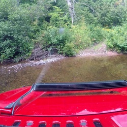
This is a moderate one way trail in Black Hills National Forest.

This trail goes by Deerfield Lake.


    Rate this Hike

    ★★★★★


Public Tracks

user_profile
cIVMTZPZ 5 years, 3 months ago
GILLETTE PRAIRIE RD
user_profile
Mark Fluegel 7 years, 2 months ago
GILLETTE PRAIRIE RD
user_profile
ChillyFern8609 7 years, 11 months ago
GILLETTE PRAIRIE RD

Elevation Profile

Seasonal Popularity

Nearby Hiking Trails

  1. Ditch Creek 02
    ★ ★ ★ ★ ★ EASY 1.3 mi
  2. Ditch Creek 10
    ★ ★ ★ ★ ★ EASY 1.8 mi
  3. Newton 08
    ★ ★ ★ ★ ★ EASY 1.1 mi
  4. Lake Alexander via Bobcat Road
    ★ ★ ★ ★ ★ MODERATE 5.1 mi
  5. Deerfield Lake via Ditch Creek 01
    ★ ★ ★ ★ ★ EASY 2.3 mi
  6. Black Hills Museum of Natural History via Deerfield Road
    ★ ★ ★ ★ ★ DIFFICULT 17.7 mi
  7. Whitetail Campground via Whitetail Loop
    ★ ★ ★ ★ ★ EASY 1.9 mi
  8. Signal Knob via Slate Prairie Road
    ★ ★ ★ ★ MODERATE 6.0 mi
  9. Deerfield Lake via Deerfield Cove Road
    ★ ★ ★ ★ EASY 1.9 mi
  10. McVey Road
    ★ ★ ★ ★ EASY 3.4 mi