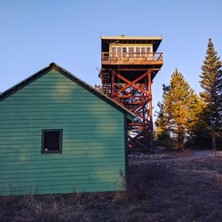
Table Mountain - Sacagawea and Papoose Rocks Loop (Heartbreak Ridge) via Pacific Crest Trail
Overview
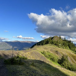
This is a hard loop trail to Sacagawea and Papoose Rocks in Gifford Pinchot National Forest.
This trail goes by Carpenters Lake. There are a number of excellent camping spots a few miles into the hike which will break up the in/out distance required to start the ascent of table mountain.
Please be sure to pack a lot of water and start early if you do this on a summer day, the top half of this hike is exposed south facing and heats up quickly.
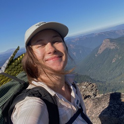
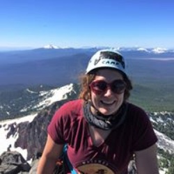
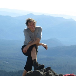
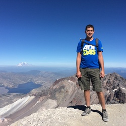
12/30/19 WA 9.49 miles with 3404ft elevation gain in 11hrs 54 mins total time, 7hrs 28 mins moving time and 4hrs 26 mins stopped time. (1438ft elevation gain in 1 mile on west way!!! To true summit from West Way TH) I seriously wonder why West is called the easier of the two!!! Every time I hike up West!! I would never go down west!! But I could def go up and down 💔.
5hrs to go up west and down 💔. Up west (begining of the rocky area was so icy (iced over rocks)!! Solid snow started maybe halfway up West and was about a foot deep on the true summit. But everything was much better with micros on). 3 false summits on West, but the true summit was windy cold with no views, just watched the clouds rolling by on the west side💖. Had a great lunch spot in a wind break area and sat in the soft snow, on the side of the trail that connects west to South side. Snow in the Forrest between west and south views was the same amount as last year at this time of year, there was also more snow this year at lower elevations. South side views were pretty socked in. We were in the clouds! Headed down 💔 the snow was crunchy (snow and frozen ground until right before the final steep descent to 💔 TH), the travel was pretty nice with the snow being crunchy like it was. Boulder field was intimidating as always, but also not as bad as it is without any snow. Most of the rocks were frozen to each other, there was snow covering the gaps, but we took care with every step and both of us did not have any sketch moments there and took our time. Saw our first and only person for the day heading up West from the Boulder field, across the way. My partner yelled over to him 🤣😂, but we got no response, later he passed us on 💔 during the super steep final descent to 💔 TH (think he was a trail runner! Dude had a tiny pack and was booking it!!) Super steep descent was also my partners least favorite (her first time on the mountain) favorite part and also broke her heart and her knees literally... To me it's usually a rough spot but because the ground was frozen, it was not as bad as it usually is.
Make sure you carry a power pack for your phone if you are relying on your phone to guide you or have a paper map as there are a lot of trails that veer off the main trails with no names especially on West Way trail.
Bring plenty of water or have a Water filtration system to filter water before you make the summit attempt. There is a stream crossing the PCT year round before 💔 TH. You will drink a lot of water on this trail.
Summit (West Way and 💔) trail is not children under 8 friendly or handicap accessible as the trail is un even with steep trail, steep drop offs, rocky terrain several overgrown areas, small stream crossings and blowdowns on trail.
There is a large camping area by Cedar Creek/Aldrich bypass trail, but accessing the creek may be tricky as it will be a bushwack. There are also camp spots on the summit as well as false summit spots on West trail you might be able to camp at, but you will have to pack in your water or snow camp and melt snow.
Park at Bonneville TH for this hike right off highway 14. Parking will be on the North side, you need an America the beautiful parks pass ($80), Northwest Forrest pass ($30) or day pass ($5.00 I believe) which you can aquire at this TH. Toilets are vaulted and can get pretty stinky. Lots of other hiking in the area as well. Parking area is large and right next to the train tracks.
Getting Started
Park at the Bonneville trailhead in Stevenson, WA and start the hike along the Tamanous trailhead towards the PCT. Make sure you have the proper passes or carry cash/check for the trailhead fee.
Taking Children
This would be a long and tough hike to complete in full with children, but would be a good hike to one of the lakes about 2-3 miles in.
Rate this Hike
★★★★★

 stars
stars
 stars
stars

Public Tracks
 stars
stars