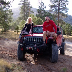
Moab Rim Trail Loop
7.8 mi
Distance
4 hrs 1 min
Time
terrain
1,358 ft
Elev Gain
Overview
This is a moderate loop trail in Behind The Rocks Wilderness Study Area.
This trail goes by Colorado River.
Rate this Hike
★★★★★

Public Tracks

MOAB RIM
Trail Length: 6.6 miles
Low-End Rating: 6
High-End Rating: 7
This trail is both tough and dangerous, so use extreme caution at all times. The difficult part starts early so it is a good idea to first park in the parking lot at the bottom and walk the first part of the trail to figure out if you and your vehicle are up to the challenge.
It is almost like two different trails set back to back, with the first section much different than the second section. The first section is extremely steep and filled with obstacles, all on slickrock and almost all right on the edge of the cliff over Kane Creek Road and the Colorado River. After the first Overlook, the second part of the trail has some slickrock and a lot of sand and dirt, none of which is on the edge of a cliff. Both sections are fun.
You start the first section going up a steep hill and continue up this hill for the first mile. This mile will take a little while, so take your time. Be sure to check out Little Arch across the river. If you go out to the end of the Poison Spider Mesa trail you can sit near the arch and watch people do the Moab Rim trail if you're lucky.
The first true obstacle is Devils Crack where you must place your left tires over an outcropping that is right on the cliff's edge in order to not get too tippy. If you are too far to the right you could roll off the edge fairly easily.
The next obstacle looks easier but it can be just as dangerous. Try to go up and down stairs with a direct approach rather than at an angle and you will end up less tippy. Each obstacle starts out at a severe slant to it makes them that much harder.
You can enjoy a little more room at the bottom of the Z Turn. This obstacle is a series of ledges and stairs that you must weave through in a "Z" by starting at the left, working your way across, and then going to your right at the top. It is big and it is challenging, with different lines to challenge the biggest of vehicles.
There are more and more steps and ledges on the way to the top, each one tilting you toward and away from the cliff. Luckily the trail gets further away from the edge as you make your way to the first Overlook at the top.
This Overlook is at the top of the chair lift that you can see from the beginning of Kane Creek Road at the bottom. This chair lift brings people up to the top so they don't have to hike up the trail which is a difficult hike. From here you can see all of Moab and Sand Flats park. You can find Lion's Back and the end of Hell's Revenge without any difficulty.
Continue on the trail away from the cliff's edge and onto trail that starts out as a dirt road. Stop to read the sign with information about the Behind The Rocks Wilderness Study Area. You must stay on the trail.
You will come to a sign marking the start of the loop at a fork in the road. The second Overlook is at the far end of this loop. Take the right side of the fork to do the loop half with the rock obstacles.
Though this side is filled with steps and stairs, the biggest attraction is an extremely steep dome of slickrock with a step in the middle. You must have some momentum to get you through it, but not so much so you bounce as you will be at an extreme angle. This dome is optional, with a bypass around it. After the dome there is a steep section going down the other side.
Follow signs to stay on the trail, and do not take the road marked Dead End and Hidden Valley Hiking Trail. Go left here instead and up to the second Overlook. There is a confusing section here but if you take a wrong turn it only takes you a couple minutes out of your way.
The second Overlook shows the southern half of Moab along with Spanish Valley and the La Sal Mountains.
After going back down from the second Overlook you take the other half of the loop, down to a sandy area and a wash (it is marked Kane Creek). There is a long and steep sandy hill you can play on that links the two halves of the loop together, so you may need to try either side to either go up it (from the sandy half) or down it (from the rocky half you came in on). It is entirely optional.
You'll eventually come back out of the loop and work your way back to the first Overlook. Then you work your way slowly down the cliff's edge. Go very slowly and carefully -- the way down is more dangerous than the way up. Again, try to go down ledges directly instead of at an angle.

Moab Rim 4.5
We have not done this trail. A bunch of our friends have done it, so it cannot be too bad.

Moab Rim 4.5
We have not done this trail. A bunch of our friends have done it, so it cannot be too bad.
Moab Rim 4.5
We have not done this trail. A bunch of our friends have done it, so it cannot be too bad.

Moab Rim 4.5
We have not done this trail. A bunch of our friends have done it, so it cannot be too bad.

Moab Rim 4.5
We have not done this trail. A bunch of our friends have done it, so it cannot be too bad.

Moab Rim 4.5
We have not done this trail. A bunch of our friends have done it, so it cannot be too bad.