San Bernadino Peak via San Bernardino Peak Divide Trail
15.8 mi
Distance
7 hrs 32 min
Time
terrain
4,669 ft
Elev Gain
Overview
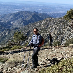
This is a difficult out and back trail to San Bernardino Peak in San Gorgonio Wilderness.
This trail goes by Limber Pine Bench and Limber Pine Spring.
Sights to See
Rate this Hike
★★★★★

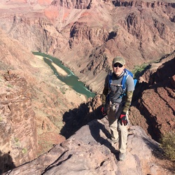
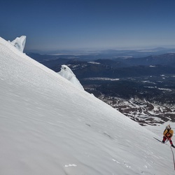
Solo hiked Jan 29 2026 - Pretty warm for an alpine start which had me overheating in a hard shell but my hoping for a cool down by the time I reached Limber Pine Bench was granted. Put on micro spikes 1/8 mile before Limber Pine once the ice was harder to bypass. Shortly after heading east from Limber Pine, the switchbacks toward Limber Pine Spring disappeared so it made sense to take a direct northwest ascent to see if the upper trail was viable and as luck would have it, it was usable. The snow provided great purchase with just micro spikes, allowing for a direct line up with no traversing. From here, I followed the trail to the normal place where the switchbacks going up to the Washington Survey Marker would start but they were drifted over. Since there is a nice northwest gully at the same location that leads up to the San Bernardino Peak ridgeline, I started going up it still wearing spikes but with a helmet and axe. For the top third of the ascent, I switched to crampons as the snow became noticeably harder and those pesky shiny patches appeared. That said, the purchase was still excellent and the pick still sank 100 percent and held full load when tested so it was still the most enjoyable part of the trek. Once on the peak, it was amazing to see how much snow is still up there. I went a little further east on the ridgeline with the thought of going out to SB east but it looked like it would take more time than I had. Nice day with no wind but a little hazy. The snow was still good enough on the way down for direct walk downs with crampons, even more enjoyable than the ascent. Whistled past the burned tree graveyard to avoid becoming a statistic and never saw anyone else which is a first for this trail. Found the glove I had dropped in the dark to cap off a nice day. Logged 14.2 mi /22.9 km & 4686 ft / 1428.3 m with Gaia
★
★
★
★
★

It’s 18 miles total but the long trail makes gradual climb fun!
The first three miles have plenty of shades but after that it’s pretty much exposed. Bring more than 3 quarts of water if you don’t want to collect and filter stream water near the top.
1/2 mile dirt road to trail parking lot was full of jagged edge rocks. My sedan clearance was fine. Small parking lot so be there early.
It took me 6:00 hours ascending and 3:20 hours descending.
★
★
★
★


Public Tracks
San Bernardino Peak (10/17/15, 6:51:30AM)
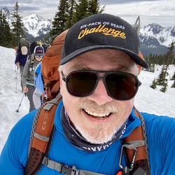
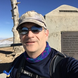
Peak #4 of 6 in the SoCal Six-Pack of Peaks Challenge.
Get my detailed trail guide, useful resources and loads more photos here:
https://socalhiker.net/hiking-san-bernardino-peak-trail/

Big Bear Hike
https://connect.garmin.com/modern/activity/17917977770

San Bernardino Peak
Start@ 5766 Frontage Road, Angeles Oaks (fire station)


 stars
stars