Mount San Antonio via Bear Canyon Trail
11.1 mi
Distance
4 hrs 29 min
Time
terrain
5,768 ft
Elev Gain
Overview
This is a difficult one way trail to Mt. Baldy Ski Lifts in Angeles National Forest.
This trail goes by West Baldy, Mount San Antonio, and Mount Harwood.
Sights to See
Rate this Hike
★★★★★

Public Tracks

Mt West Baldy, Mt Baldy, Mt Harwood - via Bear Canyon Trail 5/26/2021
Hiked with Mary, doing some training for the Mt. Whitney hike coming in July, 10/2021 The day before I hiked w/ Ernie, Jeri, John, Three T’s aka Timber, Telegraph & Thunder, via Ice House Canyon Trail. It was over 4000 ft gain, so I was not fully rested. Also, slept less than 6 hrs.
Recording: there was a little malfunction, which did not record a small area descending from Mt. Baldy.
Altitude Gain: in my opinion it is over 6,000 ft. Gaia did not add the ascent to West Baldy & Mt. Harwood, & few other smaller spots.
Active Hiking Time: between 7-8 hrs, definitely less than 8 hrs.
Trail: Started from Mt.Baldy Village, by taking the Bear Canyon Trail. Never been on this trail before. The plan was to ascend to Mt. Baldy, however we ended up doing also West Baldy & Mt. Harwood & back via Devil’s Backbone to Baldy Notch/Ski lift, then down the Mt. Baldy Road to the upper parking area at the ski lift place.
Trail Condition: from Mt. Baldy Village to Mt Baldy excellent condition. It is a all up trail, with very few spots that are flat. No dangerous cliffs if you stay on trail. We took an off trail path to reach the summit of West Baldy, then we continued via regular trail to Mt. Baldy summit. From there we descended via Devil’s Backbone Tr. & picked up the use trail to my. Harwood. From there we got back on Devil’s Backbone Trail, which is very steep, super narrow & exposed, with big scary drops on few areas. It seems to me, that the trail in these areas is in worse shape compared with last October/2020. I hope, someone will do some trail repairs soon! I can see potential accidents happening here.
Weather: it was overcast when we started & luckily stay that way for 3 miles or so. Very shortly, I had to take my windbreaker jacket off, & stayed on t-shirt all throughout the hike. Sun poke through as we reached 7000 ft. elevation. Faint breeze on and off, thankful for that! It got & felt lot hotter as we descended & reached the Baldy Notch area. Full sun all the way to the parking lot as we descended via the Mt. Baldy Rd.
Water Source: two spots on the first 1.5 mile before getting to the camp area, after that, none.
Wildlife Sightings: Large Bobcat at about 8000 ft elevation where the large white rocks area is. Squirrels, lizards & many birds.
Other Hikers: one solo man hiker passed us as we were ascending, perhaps at 2-3 miles into the hike. We met him again as we were on our way to West Baldy , maybe 900 ft elevation, or so.
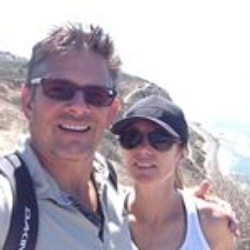
Met several hikers at the summit including a young couple with a 8 months boy, named Lincoln! I ask if I could take a photo of him & I was told ‘yes’ Which I did.
Summited West Baldy via off trail, but there were some foot prints, not sure if someone come down or went up that way. Steep with rocks. Good shoes a must! Take your time if you do this. The summit is towards the side that faces the saddle between West Baldy & Mt. Baldy. A pile of rocks & no registers. It felt amazing to be there! View 360 degrees all around. But, there was another few hundred feet up to Mt. Baldy to conquer.
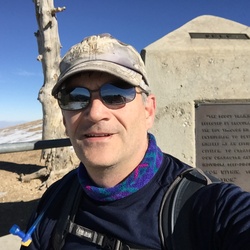
Summited Mt. Baldy after we did West Baldy. Reaching the summit felt like heaven! Gorgeous weather! No wind! Skies were just majestic! Why do I always feel like I am blessed when I hike?!! It feels that the goodness that happens is just for me! Somehow it feels like a reward for all the bad & shitty things that I’ve been going through in my life, especially recently. Anyways, it felt like a blessing. I ate my two small sandwiches, drank enough liquids & in about 10 minutes of eating & resting in the sun like a lizard, I felt ready to take summit photos & a short video (I allowed 5 minutes for this) and the continued to descend & on to Mt. Harwood.
Summited Mt. Harwood- It was maybe 100-200 ft gain here, single use trail, gentler terrain. The summit is open, few bushes here & there, rocky, but nothing bad. There are some seismic recording devices, I assume that’s what they are. From here, back on Devil’s Backbone Trail to Mt. Baldy Notch, restaurant was closed. Picked up dirt road aka Mt. Baldy Road, in between the two buildings & went down to where is splits to left, steeper & rockier, snd stayed on that to parking lot. We met a couple who ascended from the parking lot via use trail, under the ski lift, took them 3 hrs. It was hot & trail fully exposed to sun. They thought was a short cut...Very steep trail.
Got to car in a better shape than I’ve would have imagined.
We did over 6000 ft of gain in less than 7 hrs.
Mary gave me card & a box of chocolates, for helping her the other day with the car trouble/ lost key.
Drive back to home, was uneventful. Got a bit a traffic the last 5 miles, but at that point didn’t care.
Once home, I ate the rest of spaghetti diner & crushed like a log.
Gorgeous hike! I would do it again anytime.


 stars
stars