Mount Sterling via Baxter Creek Trail
Overview
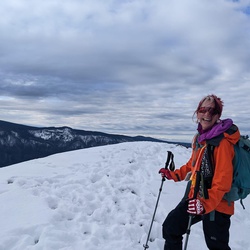
This is a difficult hike to Mount Sterling. Rising more than 4000 feet over 6 miles, Baxter Creek Trail is considered to be one of the most challenging trails in the GSMNP. From the fire tower atop Mount Sterling spectacular views are the reward on a clear day. Many people combine this trail with other area routes to form a one or two night backpacking loop, saving this trail for the descent on the last day.
Getting Started
From I-40 Exit 451 in Tennessee follow Waterville Road along the Pigeon River back into North Carolina and past the Walters hydroelectric power plant to the crossroads at Mt. Sterling settlement. Continue straight through the four-way intersection, following signs for Big Creek Campground. Park in the picnic area adjacent to the campground and look for a steel footbridge across the creek, which is the beginning of the Baxter Creek Trail.
Taking Children
This is a very difficult hike and is not suitable for younger children. Teenagers in good condition will find it a challenging but satisfying hike.
Rate this Hike
★★★★★


 stars
stars