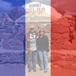
Lizard Lake via Lost Trail Road
7.7 mi
Distance
3 hrs 46 min
Time
terrain
2,213 ft
Elev Gain
Overview
This is a moderate one way trail in White River National Forest.
This trail goes by Lizard Lake and Geneva Lake Trailhead Lot.
Sights to See
Rate this Hike
★★★★★
Public Tracks

Lead King Basin - © Trails Offroad
Lead King Basin is a heavily used straight-through trail, typically combined with , to create a full loop. The trail tavels very close to the Maroon Bell-Snowmass Wilderness boundary and provides access to several popular hiking trails that enter the wilderness area.
Lead King Basin can be traveled in either direction, and neither is more difficult. The trail surface is generally hard-packed, rough dirt, with short sections of protruding rocks, occasional ruts, and intermittent water from snowmelt and runoff. Between Waypoints 2 and 3, the trail crosses an extremely narrow, exposed shale rock slope that leans towards the river canyon below. There are few pull-offs along this stretch of the trail, and drivers may be required to back up for considerable distances to pass oncoming traffic. Outside that narrow section, the remainder of the trail is generally 1.5-2 vehicles wide with abundant passing opportunities.
Along the trail's higher elevations, there are abundant dispersed camping opportunities and a great variety of wildflowers throughout the summer. Peak bloom for the flowers is generally August, but this can vary depending on winter and spring moisture levels. The fall brings pockets of golden aspens closer to the basin and along the base of Arkansas Mountain, but this trail has far fewer aspen groves than other nearby trails.
Lead King Basin is suitable for any high clearance 4WD vehicle, but longer wheelbase vehicles, especially factory clearance pickup trucks, may find sections of the trail extremely difficult. Cell service is non-existent in this area, and users should be prepared for self-recovery and carry emergency food rations and shelters as it is extremely remote.Lead King Basin is a heavily used straight-through trail, typically combined with , to create a full loop. The trail tavels very close to the Maroon Bell-Snowmass Wilderness boundary and provides access to several popular hiking trails that enter the wilderness area.
Lead King Basin can be traveled in either direction, and neither is more difficult. The trail surface is generally hard-packed, rough dirt, with short sections of protruding rocks, occasional ruts, and intermittent water from snowmelt and runoff. Between Waypoints 2 and 3, the trail crosses an extremely narrow, exposed shale rock slope that leans towards the river canyon below. There are few pull-offs along this stretch of the trail, and drivers may be required to back up for considerable distances to pass oncoming traffic. Outside that narrow section, the remainder of the trail is generally 1.5-2 vehicles wide with abundant passing opportunities.
Along the trail's higher elevations, there are abundant dispersed camping opportunities and a great variety of wildflowers throughout the summer. Peak bloom for the flowers is generally August, but this can vary depending on winter and spring moisture levels. The fall brings pockets of golden aspens closer to the basin and along the base of Arkansas Mountain, but this trail has far fewer aspen groves than other nearby trails.
Lead King Basin is suitable for any high clearance 4WD vehicle, but longer wheelbase vehicles, especially factory clearance pickup trucks, may find sections of the trail extremely difficult. Cell service is non-existent in this area, and users should be prepared for self-recovery and carry emergency food rations and shelters as it is extremely remote.

Lead King Basin
No go if the ground is wet. Terrible surface that gets impassable with rain on northern part. Extremely fine views. Southern portion in the woods and on shelf roads. Some very good views. Very rocky and rough.