Red Crater via Tongariro Alpine Crossing
12.0 mi
Distance
6 hrs 11 min
Time
terrain
3,574 ft
Elev Gain
Overview
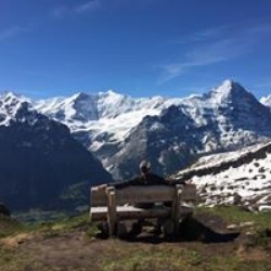
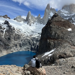
This is a difficult one way trail in Tongariro National Park.
This trail goes by Mangatepopo Hut, Devil's Staircase, Volcanic hazards, Red Crater, Emerald Lakes, Blue Lake, Volcanic Risk, and Lahar Hazard Zone.
Sights to See
Rate this Hike
★★★★★

A must do trek up and over a stark , beautiful volcanic landscape. Take extra food, water (2 liters), gloves, Goretex jacket, sun protection, short gators (keeps small volcanic stones and dirt out of boots) for the deep soft trail down from the Red Crater.
We started a bit later 0830 to avoid the earlier crowds. Worked OK. Took 3 breaks plus 30-40 mins for lunch at the top of Red Crater.
Portaloos spaced adequately. Always ‘go try’
Halfway point is approx. at Blue Lake on the downhill side. Need transportation at beginning and end.
★
★
★
★
★


This was a nice scenic hike (or trek as it is called here). The trail was nicely maintained and only a few wet spots despite the fact that it had rained for days on prior to my day on the trail. However, it is so popular so you feel like you are in the line at the grocery store at times. I hiked it during the early season and there were well over 1,000 people on the trail that day. So therefore I only give it 4 stars. It was very crowded.
★
★
★
★


Public Tracks

Tongariro Alpine Crossing
19.8km
Length
843m
Elevation gain
Point to point
Explore this 19.8-km point-to-point trail near Owhango, Manawatū-Whanganui. Generally considered a challenging route. This is a very popular area for hiking and walking, so you'll likely encounter other people while exploring. The best times to visit this trail are November through May. You'll need to leave pups at home — dogs aren't allowed on this trail.
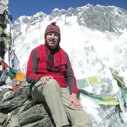
To experience what many people call the "World's Greatest Day Hike", you will need no permits, however, transportation arrangements must be made for both ends of the hike, so make sure you do some planning! You must also be mindful of shuttle pick-up times if you decide to summit Mt. Tongariro or Mt. Ngauruhoe (both cannot be done within the same day). There are sections of the hike that are considered active volcano areas, and the trail has optional side trips to Mount Tongariro and Mount Ngauruhoe (famously known as 'Mt Doom' in the Lord of the Rings trilogy) as well as passing Mount Ruapehu.
Be prepared for rapidly changing weather conditions on the route, and always have warm layers available as the peaks often have 10-15 degrees cooler temperatures. Water, sunscreen, and food for a whole day are also essential. The walking is generally straightforward, but the extreme weather and potential for a full 7-10 hours to complete earn this track the "hard" rating. It's recommended to come here in summer because of the snow at high altitudes.
Tongariro Crossing 1/10/19 09:00:55
Horrible weather. Rainy, cloudy and fogged in. Ran the downhill simply because I was bored.
Pretty fast. Finished ~1 hour before next in group and ~3 hours before our bus was supposed to arrive. Picked up a lot of trash along route. So many discarded, wet tissues!

Tongariro National Park Hike
https://connect.garmin.com/modern/activity/21118626860
Manawatu-Whanganui Hike
https://connect.garmin.com/modern/activity/20896572776

Te Araroa day 42
https://connect.garmin.com/modern/activity/17853661345