Utah Pronghorn Units La Sal, Potash/South Cisco
96.5%
Public Land
935,930
acres
6,410 / 3,818ft
Min/Max Elevation
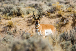
Utah La Sal, Potash/South Cisco - Unit Overview
Unit La Sal, Potash/South Cisco for antelope covers approximately 935,930 acres, and the majority of this unit is comprised of public land. The dominant land cover for Unit La Sal, Potash/South Cisco is shrub/scrub. From September through December, this unit receives an average of 0.81 inches of precipitation a month and the heaviest rainfall is in October. Temperatures during hunting seasons typically range from 29°F to 66°F.
Species
Antelope
Average Temperature
Average Precipitation
Utah Hunting Maps App
Download today, and you can record, track, and navigate for free.
