Utah Mountain Goat Units Wasatch Mtns, Lone Peak
52.5%
Public Land
153,877
acres
11,348 / 4,235ft
Min/Max Elevation
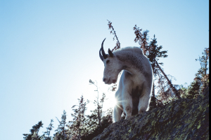
Utah Wasatch Mtns, Lone Peak - Unit Overview
Unit Wasatch Mtns, Lone Peak for Rocky Mountain Goat covers approximately 153,877 acres, and roughly half of this unit is comprised of public land. The dominant land cover for Unit Wasatch Mtns, Lone Peak is evergreen forest. From September through December, this unit receives an average of 2.37 inches of precipitation a month and the heaviest rainfall is in December. Temperatures during hunting seasons typically range from 24°F to 55°F.
Species
Rocky Mountain Goat
Average Temperature
Average Precipitation
Utah Hunting Maps App
Download today, and you can record, track, and navigate for free.
