Utah Deer Limited Entry La Sal, Dolores Triangle
95.0%
Public Land
117,050
acres
7,673 / 4,068ft
Min/Max Elevation
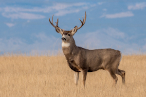
Utah La Sal, Dolores Triangle - Unit Overview
Unit La Sal, Dolores Triangle for mule deer covers approximately 117,050 acres, and the majority of this unit is comprised of public land. The dominant land cover for Unit La Sal, Dolores Triangle is shrub/scrub. From September through December, this unit receives an average of 0.98 inches of precipitation a month and the heaviest rainfall is in October. Temperatures during hunting seasons typically range from 28°F to 64°F.
Species
Mule Deer
Average Temperature
Average Precipitation
Utah Hunting Maps App
Download today, and you can record, track, and navigate for free.
