
United States
›
Texas
›
Guadalupe Mountains National Park

Best Hiking Trails in Guadalupe Mountains National Park

119 reviews


link Copy Link email Email directions Driving Directions

Seasonal Popularity

Overview

Silvery gypsum sand dunes? Forested limestone canyons? The highest peaks in Texas? Guadalupe Mountains National Park has it all. And geological variety isn't even the whole story—here, you'll also find prehistoric fossils, rare endemic flowers, and 10,000 years of cultural history ranging from intense indigenous conflict to the storied Buffalo Soldiers of the Civil War. And with way lower visitation numbers than any America's marquee national parks, it remains one of the best hidden gems in Texas.

Getting Started

Getting there
Guadalupe Mountains National Park is in far western Texas, about a 2-hour drive east of El Paso.

Within the park, there's no shuttle, and the park road system is somewhat limited, but that just means more room for trails. In fact, over 80 miles of trail criss-cross the park's backcountry, making it ideal for hikers and backpackers hunting for solitude.

Hiking
For a lush, shaded hike, try the 4.7-mile out-and-back along McKittrick Canyon. Come fall, the oaks and maples lining the canyon floor turn red and orange, making it one of the best spots around for leaf-peeping.

Prefer a little more exposure? Tag the summit of 8,750-foot Guadalupe Peak. The trail switchbacks up 2,8000 vertical feet over just 4.1 miles but the view is plenty reward.

If you've got a little more time, the 27.2-mile Lost Peak Loop comes highly recommended. It wanders through yucca, wildflowers, and open vistas across the corrugated hills of the high desert.

Camping
Camping is available in 10 designated backcountry sites as well as in two established campgrounds: Dog Canyon and Pine Springs. Dog Canyon is at a slightly higher elevation, and the resulting cooler temperatures make it a better option for summer. However, it's also much smaller than Pine Springs.

Both campgrounds offer pretty sparse amenities (just potable water and restrooms), and are first-come, first-served. A fee is required (self-pay at the kiosk.) Only group campsites currently allow reservations.

When to Go

The park and campgrounds are open year-round, and the park's low latitude and high elevation mean it's typically pretty pleasant. As in any mountain region, however, you should always be prepared for unexpected weather.

Expect higher temperatures in the spring and summer (up to 80°F), and milder daytime temperatures and colder nights during fall and winter.

Permits

To enter the park, you'll need either a day pass or an annual pass. You can read more about accepted passes on the national park website.

You'll also need a permit for backcountry camping, which you can pick up at one of the visitor centers.

Dog Info

Pets are prohibited in the backcountry but are allowed in frontcountry campsites and along paved roads. Pets must be on a leash and must be picked up after.


Resources

  • nps.gov
  • wikipedia

  • Hiking Trails (26)
  • Reviews (119)
  1. 1
    Guadalupe Peak
    ★ ★ ★ ★ ★ DIFFICULT 4.1 mi
  2. 2
    McKittrick Canyon Trail
    ★ ★ ★ ★ ★ EASY 4.7 mi
  3. 3
    Hunter Peak Loop via Tejas Trail
    ★ ★ ★ ★ ★ DIFFICULT 9.9 mi
  4. 4
    Frijole Trail and Foothills Trail Loop
    ★ ★ ★ ★ ★ MODERATE 5.3 mi
  5. 5
    Smith Spring Loop
    ★ ★ ★ ★ ★ MODERATE 7.4 mi
  6. 6
    Hunter Peak Loop via Tejas Trail
    ★ ★ ★ ★ ★ DIFFICULT 8.3 mi
  7. 7
    Lost Peak Loop via Bush Mountain Trail and Tejas Trail
    ★ ★ ★ ★ DIFFICULT 27.2 mi
  8. 8
    Bush Mountain Loop
    ★ ★ ★ ★ DIFFICULT 27.4 mi
  9. 9
    Tejas Trail
    ★ ★ ★ ★ MODERATE 3.8 mi
  10. 10
    Lost Peak Loop via Dog Canyon Trail
    ★ ★ ★ DIFFICULT 13.6 mi
    user_profile
    Geoff K 4 months, 1 week ago
    Devil’s Hall GMNP
    Geologically this is a very fun hike.
    ★ ★ ★ ★ ★

    user_profile
    QuickFrost7269 8 months, 1 week ago
    Guadalupe mountain south side
    Guadalupe Mountains south side.
    ★ ★ ★ ★ ★

    user_profile
    QuickFrost7269 8 months, 1 week ago
    Tuesday Morning Activity
    This is the Texas Trail and El Capitan Trail at the Guadulape Mountain. We rode horses and mules. This is the south side and we will be riding 3 days on the north side of the mountain. It’s a wonderful place to ride in the spring and fall.
    ★ ★ ★ ★ ★

    user_profile
    GentlePine3188 1 year, 6 months ago
    Track (11/24/24, 10:40:09AM)top of Texas
    Top of Texas! Hard but worth it.
    ★ ★ ★ ★ ★

    user_profile
    Carlos Chavez 2 years, 6 months ago
    Saturday
    A freakin forest…in the desert! Pine trees, pine cones, leaves…sometimes I felt like I was walking a trail in Arkansas or Alabama. Incredible. Majestic. Highly recommend.
    ★ ★ ★ ★ ★

    user_profile
    Carlos Chavez 2 years, 6 months ago
    Saturday
    A freakin forest…in the desert! Pine trees, pine cones, leaves…sometimes I felt like I was walking a trail in Arkansas or Alabama. Incredible. Majestic. Highly recommend.
    ★ ★ ★ ★ ★

    user_profile
    Carlos Chavez 2 years, 6 months ago
    Saturday
    A freakin forest…in the desert! Pine trees, pine cones, leaves…sometimes I felt like I was walking a trail in Arkansas or Alabama. Incredible. Majestic. Highly recommend.
    ★ ★ ★ ★ ★

    user_profile
    brad 3 years, 1 month ago
    Guadalupe Peak
    Following the example of another hiker who climbed yesterday, I left at 5:30 AM with my headlamp (which I only needed for the first 3 miles). There’s plenty of elevation gain on this climb so plan accordingly and give yourself time if you’re not used to these type of hikes. I made it to the top in 2 hours and enjoyed a lovely sunrise. Fairly strong Westerly winds at the top that decreases as soon as you’re on the other side. Overall it was a super enjoyable hike with a beautiful 360 view at the top. What are you waiting for? Get up there already!
    ★ ★ ★ ★ ★

    user_profile
    BrightWind3871 3 years, 7 months ago
    Smith springs morning hike
    Pretty hike, waterfall was flowing. Area around waterfall was well shaded; perfect for a picnic lunch. I hiked starting at sunrise, did the loop counterclockwise.
    ★ ★ ★ ★

    user_profile
    FunkyCypress4958 3 years, 11 months ago
    Pine Springs Visitor Center Parking Lot, Culberson County to 400 Pine Canyon Drive, Pine Springs, TX, USA
    Nice little walk to the stagecoach stop in Guadalupe National Park. Start at the park offices and gift shop.
    ★ ★ ★

    user_profile
    Roger Leischner 4 years, 5 months ago
    Guadelupe
    It was a great workout, be prepared for any weather. About 16 degrees cooler, and add 15 knots to the wind speed at the visitor center .
    ★ ★ ★ ★

    user_profile
    FeistyBelay3563 4 years, 6 months ago
    McKittrick Canyon to Grotto
    Gorgeous mountains and fall colors on a mostly flat, well maintained trail. The Grotto is worth the extra couple of miles.
    ★ ★ ★ ★ ★

    user_profile
    Roger Leischner 4 years, 6 months ago
    Guadelupe
    It was a great workout, be prepared for any weather. About 16 degrees cooler, and add 15 knots to the wind speed at the visitor center .
    ★ ★ ★ ★

    user_profile
    Roger Leischner 4 years, 6 months ago
    Guadelupe
    It was a great workout, be prepared for any weather. About 16 degrees cooler, and add 15 knots to the wind speed at the visitor center .
    ★ ★ ★ ★

    user_profile
    TallVine3961 4 years, 7 months ago
    Guadalupe Peak !
    First push was brutal, however once you get past that it’s a breeze up until you get just a few feet away from the peak. You have to basically climb your way up. Hike down was much more enjoyable than the one up, as one would assume. Scenery was absolutely beautiful. 10/10 hike definitely recommend. My only suggestions are to bring trekking poles, a backpack, foods high in carbohydrates and plenty of water. Be prepared for some rough terrain. On the way down I jokingly counted how many times I rolled my ankle, and it was eleven. 😂
    ★ ★ ★ ★ ★

    user_profile
    CoolKayak4423 4 years, 7 months ago
    Guadalupe Peak
    This was a nice hike on a beautifully maintained trail. Views from the top are worth the effort. Don’t listen to the horror stories from novices saying had hard and poor the trail is they are clueless beginners.
    ★ ★ ★ ★

    user_profile
    CalmFrost8887 4 years, 10 months ago
    El Capitan Trail and Salt Basin Overlook Trail Loop
    One of the most beautiful places in Texas. Highly recommend.
    ★ ★ ★ ★ ★

    user_profile
    HumidClover5318 4 years, 11 months ago
    Guadalupe Peak
    Very challenging hike with great views. Started early and it was very cool though warmed up to about 82 in the afternoon. The dry, cool climate make the ascent much more manageable than would be the case if it were hotter. View from the peak is well worth the trip. Downhill goes fast but can be rough on the toes. Lace those shoes tight. Can be crowded on weekends.
    ★ ★ ★ ★

    user_profile
    AbleRappel9582 5 years, 1 month ago
    Guadalupe Peak
    I came into this hike pretty unprepared. I do barre often, and I walk a lot for my job. However, I should have done lunges and bleachers. Here we are. We started our hike at 8am, and we finished at 1:00pm (trailhead to peak and back). It was in the 50s when we began and around 75 when we reached the parking lot. While the first 2.5 miles were horrifically uphill and technical, it stands to mention that it really is all uphill. There’s very little relief from switchbacks and climb. However, once you hit mile 3, you begin to get shade from Douglas firs and are provided gorgeous views. I was stressed for a whole week before the hike, but it was entirely worth it. Though my legs are sore now, I loved the experience and would hike it again. Be sure to bring light layers as it’s windy up top, and have shoes with good traction.
    ★ ★ ★ ★ ★

    user_profile
    Tim Barr 5 years, 4 months ago
    Guadalupe Peak
    We went on January 17. 34° at the trail head and 25° at the peak with 30 mph winds. We started hiking at 0145 to make the peak by sunrise with was 0700 that day. We made it for a full dark to full sun experience. 4 hours is a realistic hike time. We trained by doing bleachers at the local high school with an elevation of 465 feet. We were not ready for the altitude difference. Our average was a bit over 1 mile per hour with frequent stops to rest, water and snack. The trail between the trail head and the woods is the toughest stretch. However, the trail never really gets easy at any point. The wooden bridge is not "near the top" as just about every internet review says. Yes, it is a bit over a mile from the top but the going is still strenuous after the bridge. Just use it as a marker for mile 3 completed. Mentally, you will be better off. I'm glad we made the entire hike in the dark to see the sunrise. However, just below the summit the switch back trail turn takes you to a "window" with cairns of stacked rocks on each side. You stick your head out and the wind slams you in the face. You look again and see nothing but black emptiness and a little bitty ledge of angled down rock ledge as the trail. I pulled out my iPhone to check my Gaia GPS downloaded map to make sure that little bitty ledge was actually the trail. It was. Once out on the ledge, it was one more switch back turn and the summit. Going back down in day light the ledge and "window" didn't seem so bad. But at night it was kind of unnerving. 9 hours trail head, summit and back to trail head.
    ★ ★ ★ ★
    user_profile
    Kyle 5 years, 5 months ago
    Pine Springs Campground via Devil's Hall Trail
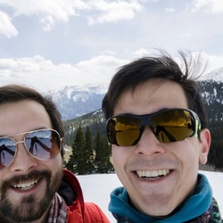
    Hiked on 11/28/2020 as a day hike wearing a light pack and hiking boots. Conditions were cold, windy, but dry. Trail was dry and easy to follow for first half, with moderate trail-finding necessary in the second half. Autumn colors were largely past peak, but in the latter half of the hike colors were more prominent. First half of the trail is a rock/dirt path following parallel to the wash, and is easy hiking. Second half of the trail enters the wash and is choose-your-own adventure, requiring some trail-finding. Final portion of the trail traverses stone formations that have been worn very smooth by foot traffic, and can be slippery. Beautiful pay-off at the end with the eponymous Devils Hall. https://www.gaiagps.com/public/PYfjPW6GklNswhbDqPo4V0Ox
    ★ ★ ★ ★ ★

    user_profile
    Kyle 5 years, 5 months ago
    Tejas Trail
    Used for the ascent and descent during a 2-night backpacking trip this Thanksgiving. Weather was clear, but cold, which made for dry trail conditions. The majority of the trail is composed of crushed stone/scree. This can make for unsure footing on steep slopes where it may shift under foot. I used hiking poles to improve my stability and avoid unnecessary falls with my heavy backpacking load. Most hikers are wearing masks, but the trail is not wide enough to maintain 6ft distance in most sections. Ascent: https://www.gaiagps.com/public/qNAsNK0r4FWlZB6XEw4H2aYX Descent: https://www.gaiagps.com/public/7IxYERMpJzMhDnZ7ULfNCj1h
    ★ ★ ★ ★ ★

    user_profile
    MildMoon6182 6 years, 7 months ago
    Track (10/9/19, 4:54:27PM)
    The springs is worth the hike.
    ★ ★ ★ ★ ★

    user_profile
    Kennedy Cliett 2 weeks, 2 days ago
    McKittrick Ridge Backcountry Campground via McKittrick Canyon Trail and Tejas Trail
    ★

    user_profile
    FierceHolly8854 2 weeks, 6 days ago
    Guadalupe Mountain NP
    ★ ★ ★ ★ ★

    user_profile
    BoldWatch3659 2 months, 3 weeks ago
    Guadalupe Peak
    ★ ★ ★ ★ ★

    user_profile
    BriefLamp2774 2 months, 3 weeks ago
    Tuesday Morning Activity
    ★ ★ ★ ★ ★

    user_profile
    HardThyme6257 4 months, 1 week ago
    Guadalupe Peak Trail
    ★ ★ ★ ★ ★

    user_profile
    ErikAtx 4 months, 4 weeks ago
    McKittrick Canyon Trail
    ★

    user_profile
    SlimCave1408 8 months, 1 week ago
    Guadalupe Peak Hike
    ★ ★ ★ ★ ★

    user_profile
    Carolyn Smith 9 months, 1 week ago
    GuadalupePeak
    ★

    user_profile
    WarmEGels8921 11 months, 1 week ago
    Guadalupe Peak
    ★ ★ ★ ★

    user_profile
    WarmEGels8921 11 months, 1 week ago
    Guadalupe Peak
    ★ ★ ★ ★

    user_profile
    YoungWetland4004 11 months, 2 weeks ago
    Devil’s Hallway
    ★ ★ ★ ★

    user_profile
    FrostyKayak2596 1 year, 1 month ago
    Guadalupe Peak
    ★

    user_profile
    TinyZipline1989 1 year, 1 month ago
    El Capitan
    ★ ★ ★ ★

    user_profile
    DrivenCedar1325 1 year, 1 month ago
    McKittrick canyon to grotto 7 miles
    ★

    user_profile
    StonehamMike 1 year, 1 month ago
    Guadalupe Peak
    ★ ★ ★ ★

    user_profile
    WarmGrove8523 1 year, 2 months ago
    Sunday Morning Activity
    ★ ★ ★ ★ ★

    user_profile
    Jessica 1 year, 2 months ago
    Guadalupe Peak
    ★ ★ ★ ★ ★

    user_profile
    Randy 1 year, 3 months ago
    Guadalupe Peak
    ★

    user_profile
    SpryVine2393 1 year, 5 months ago
    Guadalupe Peak
    ★ ★ ★ ★ ★

    user_profile
    GentlePine3188 1 year, 6 months ago
    Pratt Cabin
    ★ ★ ★ ★

    user_profile
    WiseFish5186 2 years ago
    Guadalupe Peak Campground via Guadalupe Peak Trail
    ★

    user_profile
    WiseFish5186 2 years ago
    Guadalupe Peak
    ★ ★

    user_profile
    LightDune4778 2 years, 1 month ago
    Track (4/20/24, 3:20:42PM)
    ★ ★ ★ ★ ★

    user_profile
    Xy60U 2 years, 1 month ago
    Track (4/9/24, 11:02:17AM)
    ★ ★ ★ ★ ★

    user_profile
    TinyCaving5914 2 years, 1 month ago
    Pine Springs Campground via Devil's Hall Trail
    ★ ★

    user_profile
    mrmelrod 2 years, 2 months ago
    Guadalupe Peak 03/26/24
    ★ ★ ★ ★ ★

    user_profile
    OdwMXm 2 years, 2 months ago
    Track (3/13/24, 10:22:45AM)
    ★ ★ ★ ★ ★

    user_profile
    SlimRedwood1829 2 years, 2 months ago
    Guadalupe Peak
    ★ ★ ★ ★ ★

    user_profile
    SafeFern8762 2 years, 3 months ago
    MaKittrich trail Guadalupe Park
    ★ ★

    user_profile
    Stephen McLemore 2 years, 3 months ago
    Guadalupe Peak
    ★ ★ ★ ★ ★

    user_profile
    Stephen McLemore 2 years, 3 months ago
    Guadalupe Peak
    ★ ★ ★ ★ ★

    user_profile
    ssgustafson 2 years, 4 months ago
    Guadalupe Pk 19 Jan 2024
    ★ ★ ★ ★ ★

    user_profile
    mwcobb58 2 years, 6 months ago
    Mckittrick Canyon to Pratt Lodge
    ★ ★ ★ ★

    user_profile
    cmcfall 2 years, 6 months ago
    Tejas Trail / Bush Mountain Loop
    ★ ★ ★ ★ ★

    user_profile
    Paco Antuna 2 years, 7 months ago
    Hunter Peak via Bear Canyon Trail (10/14/23, 8:26:42AM)
    ★ ★ ★ ★ ★

    user_profile
    VastBamboo8488 2 years, 7 months ago
    Devil’s Staircase and Beyond
    ★ ★ ★

    user_profile
    Miguel Chavez 2 years, 8 months ago
    Track (9/17/23, 8:20:41AM)
    ★ ★ ★ ★ ★

    user_profile
    MildGloves4467 3 years ago
    Guadalupe Peak
    ★ ★

    user_profile
    Peter Bennett 3 years, 1 month ago
    Guadalupe Peak
    ★

    user_profile
    DawnRain6733 3 years, 2 months ago
    Guadalupe Peak
    ★

    user_profile
    EasyTri4997 3 years, 2 months ago
    Guadalupe Peak, TX
    ★ ★ ★ ★ ★

    user_profile
    John Marquez 3 years, 2 months ago
    Devil’s Hall
    ★ ★ ★ ★ ★

    user_profile
    moenkopi47 3 years, 3 months ago
    Track (1/29/23, 10:26:44AM)
    ★ ★ ★ ★ ★

    user_profile
    ssgustafson 3 years, 5 months ago
    Guadalupe Peak
    ★ ★

    user_profile
    Sterling McClelland 3 years, 6 months ago
    Guadalupe mountain summit
    ★ ★ ★ ★ ★

    user_profile
    Miguel Chavez 3 years, 6 months ago
    Track (11/13/22, 5:47:20AM)Guadalupe Peak
    ★ ★ ★ ★ ★

    user_profile
    Miguel Chavez 3 years, 6 months ago
    Track (11/6/22, 7:01:32AM)Guadalupe Mountains Hunter Peak
    ★ ★ ★ ★ ★

    user_profile
    Miguel Chavez 3 years, 6 months ago
    Track (10/30/22, 9:22:31AM)Mc Kittrick Canyon trail to the Notch 11 miles
    ★ ★ ★ ★ ★

    user_profile
    SharpBluff4227 3 years, 7 months ago
    Track (9/17/22, 4:21:16AM)
    ★ ★ ★ ★ ★

    user_profile
    Miguel Chavez 3 years, 8 months ago
    Hunter Peak Loop via Tejas Trail
    ★ ★ ★ ★ ★

    user_profile
    SlowPalm8314 3 years, 8 months ago
    Track (5/16/21, 7:21:50AM) Guad Peak
    ★ ★ ★ ★ ★

    user_profile
    TrueSwamp5306 3 years, 8 months ago
    Hunter Peak Loop via Tejas Trail
    ★

    user_profile
    RichSwamp4924 3 years, 10 months ago
    Guadalupe Peak
    ★ ★ ★ ★ ★

    user_profile
    BoldGlide2554 3 years, 11 months ago
    Devil’s Hall
    ★ ★ ★ ★ ★

    user_profile
    NobleCanoe6317 4 years ago
    Track (4/27/22, 12:58:20PM)
    ★ ★ ★

    user_profile
    RareSage2055 4 years ago
    Track (5/13/22, 8:22:06AM)
    ★ ★ ★

    user_profile
    RareSage2055 4 years ago
    Track (5/12/22, 8:22:19AM)
    ★ ★ ★ ★

    user_profile
    RareSage2055 4 years ago
    McKittrick Canyon Trail
    ★ ★ ★ ★

    user_profile
    TheMexicanMennonite 4 years ago
    Permian Reef O/B
    ★ ★ ★ ★ ★

    user_profile
    HardLowland7078 4 years, 3 months ago
    Guadalupe Peak
    ★ ★ ★

    user_profile
    MistyHike6039 4 years, 3 months ago
    Guadalupe Peak
    ★ ★ ★ ★ ★

    user_profile
    NewPoncho2599 4 years, 5 months ago
    Track (12/2/21, 7:03:15AM)
    ★ ★ ★ ★ ★

    user_profile
    Robert Witowski 4 years, 8 months ago
    Guadalupe Peak
    ★ ★ ★

    user_profile
    PureReef8441 4 years, 8 months ago
    Guadalupe Peak
    ★ ★

    user_profile
    FrostyHill6642 4 years, 9 months ago
    McKittrick Canyon Trail
    ★ ★ ★

    user_profile
    johng6103 4 years, 10 months ago
    Track (7/17/21, 8:10:44AM)
    ★ ★ ★ ★

    user_profile
    QuietRain5041 4 years, 11 months ago
    Guadalupe Peak
    ★ ★ ★ ★ ★

    user_profile
    HappyCypress3162 5 years, 1 month ago
    Guadalupe Peak
    ★ ★ ★ ★ ★

    user_profile
    SafeSage3086 5 years, 2 months ago
    Devils hall
    ★ ★ ★ ★ ★

    user_profile
    SafeSage3086 5 years, 2 months ago
    Hunter peak via frijole, bear canyon, juniper, and Tejas trails
    ★ ★ ★ ★ ★

    user_profile
    SafeSage3086 5 years, 2 months ago
    Pine Canyon Drive to Guadalupe Peak
    ★ ★ ★ ★ ★

    user_profile
    Ryan Harris 5 years, 2 months ago
    Track (3/9/21, 7:23:43AM)
    ★ ★ ★ ★ ★

    user_profile
    FastRain7585 5 years, 3 months ago
    Guadalupe Peak
    ★ ★ ★ ★ ★

    user_profile
    YoungDawn1573 5 years, 3 months ago
    Devil’s Hall, Guadalupe Mountains NP
    ★ ★ ★ ★ ★

    user_profile
    FastJetboil5461 5 years, 3 months ago
    Full Trek back
    ★ ★ ★ ★ ★

    user_profile
    RichSkis4947 5 years, 4 months ago
    Bush Mountain
    ★

    user_profile
    FairHaven6458 5 years, 5 months ago
    Guadalupe Peak
    ★

    user_profile
    Miguel Chavez 5 years, 6 months ago
    Pista (11/15/20 9:09:59a. m.)Mckittrik, The Notch
    ★ ★ ★ ★ ★

    user_profile
    BraveField7008 5 years, 7 months ago
    Bush Mountain Loop
    ★ ★ ★ ★ ★

    user_profile
    LastTulip8848 6 years ago
    Guadalupe Peak
    ★

    user_profile
    Carla Fulton 6 years, 2 months ago
    Guadalupe Peak
    ★ ★ ★ ★ ★
    user_profile
    CalmCaving5196 6 years, 2 months ago
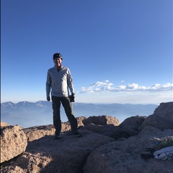
    Tajas Trail, Guadalupe
    ★ ★ ★ ★ ★


    user_profile
    David Collins 6 years, 3 months ago
    Track (2/28/20, 3:50:51PM)
    ★ ★ ★ ★ ★


    user_profile
    ChillyValley5240 6 years, 3 months ago
    Track (2/16/20, 10:14:50AM)
    ★ ★ ★ ★ ★



    user_profile
    Gilbert Juarez 6 years, 4 months ago
    End of the year hike with tots
    ★ ★ ★ ★ ★

    user_profile
    Mary Bauer Carter 6 years, 5 months ago
    Tejas Trail
    ★ ★ ★ ★ ★

    user_profile
    Karthik 6 years, 5 months ago
    Guadalupe Peak(12/1/19, 9:43:08AM)
    ★ ★ ★ ★ ★

    user_profile
    John Haraldsen 6 years, 5 months ago
    Smith Spring
    ★ ★ ★ ★

    user_profile
    BrightMist4763 6 years, 6 months ago
    Smith Spring Loop Guadalupe NP
    ★ ★ ★ ★ ★

    user_profile
    Jeremy 6 years, 6 months ago
    McKittrick Ridge Campground via McKittrick Canyon Trail
    ★ ★ ★ ★ ★

    user_profile
    WiseThunder5332 6 years, 7 months ago
    Guadalupe Peak (10/17/19, 11:58:57)
    ★ ★ ★ ★

    user_profile
    BrightRaceBib8602 6 years, 9 months ago
    New Track 8/10/19 7:54:03 AM
    ★ ★ ★ ★

    user_profile
    BrightRaceBib8602 6 years, 9 months ago
    New Track 8/11/19 9:20:33 AM
    ★

    user_profile
    ShyBike9540 6 years, 11 months ago
    Pine Spring Canyon to Pine Springs Campground, Culberson County, TX, USA
    ★ ★ ★ ★ ★

    user_profile
    LastIsland1564 7 years ago
    Devils Hall, Guadalupe National Park
    ★ ★ ★ ★

    user_profile
    Gilbert Juarez 7 years, 1 month ago
    ★ ★ ★ ★ ★