No I would not hike it again. Off trail hiking and difficult to navigate through thick forest and down trees. Not many views unfortunately.
★
★
★

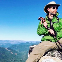
Amazing place to backpack and enjoy beautiful lakes and places to explore with amazing views of cliffs and rock formations
★
★
★
★
★

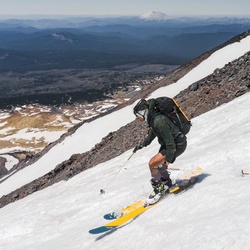
Quite difficult - for various reasons. The elevation gain on itself is decent and not too bad. The last third of trail gains most of it though and is steep. While still in the forest the trail turns to have large boulders and it becomes a partial climbing effort. Despite hiking this in mid June large snowfields come up that completely cover the trail and you are dependent on the hiking app to guide you as there is so little foot traffic that you don’t have orientation from that either. Once you reach the ridge the trail is only slick rock or massive boulders and hiking through is difficult. You are also very wind exposed and temperatures drop considerably. I switched to hat, wind breaker and gloves. I see that one person switched to rather hike up the snow field to the right instead of going through the rocky ridge. That has its own challenges since steep and moving onto the snowfield you have to be careful because where is hits the rocks there is some melting and ice overhanging that is thin and non-supporting and dangerous. You finally reach the top and have amazing views of not in clouds. I could only see east, northeast and southeast due to clouds. No great seating options on top.
Downhill is much easier if you take the snowfields. I did for most of this upper third of the trail. Some of it is steep and I slid down almost like a sliding adventure. That was not only fun but takes you past the challenging rocky ridge and saves tons of time for otherwise treacherous hiking down. I think it was 4 hours up and one and a half down it felt.
Difficult but worthwhile hike if you don’t mind borderline climbing a bit.
★
★
★
★
★

I forgot how hard this hike is—even Brent and Christopher had trouble negotiating trail down
★
★
★
You’re going to posthole even with snowshoes. I’d recommend a start earlier than 6am or bring skis. I ended up losing my snowshoes and a hiking pole on this mountain! If anyone sees a black diamond hiking pole and a pair of highlander elite snowshoes (designed in the French Alps) let me know! Otherwise, the views are great! It’s worth the climb and the postholing.
★
★
★
★

Nice hike. Did it as a day hike. 6.3 miles each way according to GPS. Great for dogs. Pretty flat especially the first half. A couple small creek crossing.
★
★
★
★
★

Good hike to do once for the views. Hike is tough as its about 4K elevation gain. It took about 6 hours up and down. Trail is pretty easy to follow. There are a lot of reports of people getting lost. Don’t let this deter you. Just follow the white dots and stay on the ridge. The top section is probably too difficult for dogs. Bring enough water.
★
★
★
★
★
This route into Cliff Lake is steep and rocky. There are better options if Cliff Lake is your destination.
★
★
★

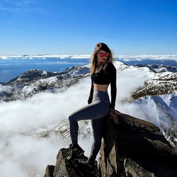
Amazing views from the top but difficult hike. Be comfortable with heights and steep hiking. Bring plenty of water, gps map, bug spray, trekking poles, sunscreen, and food for a 10 hr trek.
★
★
★
★
★