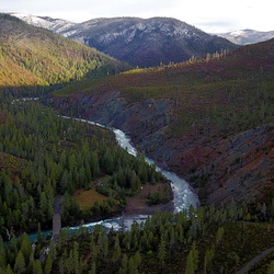
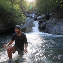
Awesome drive over Bear camp as usual. Some good cliff jumping and river swimming and sunburns to show. Traffic over the hill could be a little less reckless but we survived
★
★
★
★
★

Least amount of whitewater day, but still fun. Stopping for lunch at Flora dell waterfall and rock jumping
★
★
★
★
★

Nice trail. No downed trees. Water crossings so wear good shoes. Good views at the edge of the Rock Meadows. Falls are better viewed from opposite side of Muir Creek.
★
★
★
★

Amazing place to backpack and enjoy beautiful lakes and places to explore with amazing views of cliffs and rock formations
★
★
★
★
★

Good p line to fire spot with dug line all the way around the spot
★
★
★
★
★

Quite difficult - for various reasons. The elevation gain on itself is decent and not too bad. The last third of trail gains most of it though and is steep. While still in the forest the trail turns to have large boulders and it becomes a partial climbing effort. Despite hiking this in mid June large snowfields come up that completely cover the trail and you are dependent on the hiking app to guide you as there is so little foot traffic that you don’t have orientation from that either. Once you reach the ridge the trail is only slick rock or massive boulders and hiking through is difficult. You are also very wind exposed and temperatures drop considerably. I switched to hat, wind breaker and gloves. I see that one person switched to rather hike up the snow field to the right instead of going through the rocky ridge. That has its own challenges since steep and moving onto the snowfield you have to be careful because where is hits the rocks there is some melting and ice overhanging that is thin and non-supporting and dangerous. You finally reach the top and have amazing views of not in clouds. I could only see east, northeast and southeast due to clouds. No great seating options on top.
Downhill is much easier if you take the snowfields. I did for most of this upper third of the trail. Some of it is steep and I slid down almost like a sliding adventure. That was not only fun but takes you past the challenging rocky ridge and saves tons of time for otherwise treacherous hiking down. I think it was 4 hours up and one and a half down it felt.
Difficult but worthwhile hike if you don’t mind borderline climbing a bit.
★
★
★
★
★

Acorn Woman Lake, Elliot Creek Ridge to back’O Stein Butte
8 o’clock mosquito-filled start at the bottom of the road leading up to Acorn Woman Lookout but going the other way today. I think I’ll be on roads quite a bit today until I get to the ridge that ended my hike on Stein Butte.
Hike up to Elliot Creek Ridge gave glimpses of Little Grayback and even Acorn Woman LO. Steady climb over 1000’ to Elliot Ridge and the junction to Stein Mtn Tr—much of the track with serpentine rocks and where Tr 929 becomes a trail instead of a road, even a couple enormous Jeffery Pines.
Doubling back from the ridge to Stein to continue my loop and taking the 926 branch to Summit Lake. This part of my hike will take me to my highest spots of almost 5000 feet. The descent to the lake signals an “all downhill from here” point in my hike. Too bad Summit Lake turns out to be nothing but a grassy meadow but it’s a good place to take a rest
The next part of the hike descending to Acorn Woman Lakes is easily the best naturewise. It’s a little steep, but filled with ultramafic plant species. Can’t wait to find out what the yellow lily is, and I think I found some additional species of Coralroot orchids
Finally down to the lake parking lot, which is very full on a Sunday afternoon and a 2 mile hike back to my car which I do in about 40 minutes—my best pace yet getting to the car. I see it’s 95° on this road and as I drive back home, it’s 102 in a Ruch.
★
★
★
★
★
Little Grayback and Acorn Woman Peaks
Back to hiking solo and really missing Yuying
Very cool 9:30 start to my hike. Cloudy, but no chance of rain. The road to the lower Grayback trailhead is sketchy in my Subaru, but I make it straddling deep ruts with no problem.
Lots of flowers on the familiar Little Grayback trail, and even a black bear poop! Lots and lots of views of snow colored peaks south and west towards the Red Buttes and other familiar mountains that a one day hike. At the place that I would’ve turned north on my previous hike to Mount Baldy I cut to the right and revisit the path I missed last year up Acorn Woman Trail. This is close to the upper Little Grayback trailhead, but I can’t access it from the Applegate Lake side. I have to get on road 20 and access it from the east. this will make for good future hiking and may even get me back to Stein Butte from the east.
No, I’m on new trail heading to Acorn Woman Summit. This hike reminds me a lot of the trails on this side that open up into grassy areas and then close off the deep Doug-fir and Ponderosa Pine forest. The ridges are beautiful and the last bit to the summit is rocky. Nice view of Acorn Woman Lake down below. I have my lunch inside the shelter which apparently is available for rent and has a road that three motorcycles easily made their way up to. It was less than 6 miles here and the total day would turn out to be about 11 miles with a 2000 foot elevation game pretty good solo day I must say.
★
★
★
★
★

Such a relaxing little trail. Several small creek crossings provide fresh air and plenty of foliage.
★
★
★
★
★
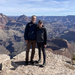
Nice easy hike along the rogue. Some nice views. The river eventually flattens out and is much quieter. The forest was lovely and quiet. Nob Falls is an impressive display of the power of water and the Natural Bridge is lovely.
★
★
★
★


Tuesday, July 16, 2024. Hike to Mount Ashland, Time Warp, Wagner Glade, Splitrock Trail loop. Cool morning with threat of thunderstorms in the forecast. Hoping for a cold front.
Leg 1
Hike starts off very similar to the Splitrock Trail. Steady decline going into Douglas-fir woods. The trees get thicker and thicker with lots of large, dead Douglas-firs and cooler as we get into moister forest. Expecting a bear at every turn, ha ha. It’s fun to walk down damp DG trails with excellent footing. Forest opens up getting closer to the road 2060 and there are some large Sugar and Ponderosa Pines. 4.6 miles down to this point and almost 2500’ of elevation loss. Good pace despite all the pictures I’m taking with about 25 minute miles. 10:35
Leg 2
It is 7 1/2 miles to Horn Gap on Forest Road 2060 but I only have to hike about half of that. 4 Corners Rd. is 4 1/2 miles the other way. The woods I came through to get onto the road need thinning or fire, but the woods below me are pretty well thinned. Cool hike, and occasional creeks coming out of ravines and feeding ashland Creek below. Made it to Wagner Glade Trail at 12:45. I am now at 10.2 miles. It is 2.2 miles to Wagner Gap and 5.3 miles to Forest Road 20. Average pace now less than 24 minute miles.
Leg 3 to Wagner Gap
Longer Trail up than last time, ha ha. Quite a bit of elevation gain to gap. Just before the gap, there’s a line of red T-posts cutting across. Also, the weather is freshening with a lovely breeze and significant drop in temperature and cloudiness. I hear thunder in the distance. Keep my fingers crossed. I’m now at 2100’ of elevation game and it’s 3:05, behind schedule.
Leg 4, Splitrock Trail
The clouds continued to build and I felt a few drops before they dispersed. As I climbed Splitrock, the sun began to break through the clouds, but it’s stayed cool and breezy, especially in open areas and on the tops. I thought the climb up Splitrock was going to kill me. Still a few miles to go… lightning from the thunderstorm has set a fire west of me on the ridge heading north from Big Red Mountain. Climbing McDonald not so bad, but I am feeling every step up in elevation. Get to road finally and have a nice talk with four older hikers starting the late afternoon ramble.
Leg Denouement— two or so miles down road at a nice gentle incline go very quick and bring my overall speed to less than 30 minute miles
★
★
★
★

Uphill, but a beautiful old growth stand of Dougs and Port Orford Cedars. Waterfall was pretty and close to the trailhead.
★
★
★
★
Uphill, but a beautiful old growth stand of Dougs and Port Orford Cedars. Waterfall was pretty and close to the trailhead.
★
★
★
★
Uphill, but a beautiful old growth stand of Dougs and Port Orford Cedars. Waterfall was pretty and close to the trailhead.
★
★
★
★
Saturday, July 6, 2024 up Tolman Creek to Bill Epstein TH towards Lamb’s Saddle/Coggins Saddle (4-Corners). Red Warning day and already 78° F at the beginning of the hike
Toothpick trail was nice. Just a flat traverse to Lamb Saddle, then a climb up a logging road towards Coggins Saddle— so close to four corners. And then back to Lambs Saddle via Marty Trail. Marty Trail looks like a fun mountain biking trail, very steep in sections with banked turns. I took the more gentle path at each junction. Lots of bikers out today! Taking the Miners Trail traversing along the ravine. Lots of enormous Douglas-firs on this cooler, wetter area of woods. It opens up to very rocky trail challenges with lots of trail challenges and Poison Oak. It would have been better to just stop at the mine or taken the first 3/4 miles
★
★
★
Tuesday, July 2, 2024, race up Wagner Butte. 18.5# backpack
Cool start at 8:20. Looking forward to views of mountains in the vicinity that I’ve climbed.
4 minutes uphill to road, ha ha!
25 minutes to Meadow!
34 minutes to Sheep Creek Slide
50 minutes to Sagebrush at 960 feet elevation game
1:29 hour to Wagner Gap
2:20 hours to summit (28:19 minute-miles)—New Record!
11:15 start down, in parking lot at 1:00!
1:45 hour down (Total hike, 4:07 hours), so must be about 21:47 minute-miles down
(25:03 minute-miles overall)
★
★
★
★
Saturday, June 22, 2024. Late 10am start at the base of Dutchmans Peak. Heading up 40 S01 around Observation Peak. The smoke is visible in the valley and obscures a lot of the faraway peaks around this point. I can see Shasta and Mount Eddie, snowcapped to the south and other familiar peaks to the west. Hope to get some better pictures of them from higher up.
Lots of snow on the side of the road and creeks flowing. Beautiful wet, spring wildflowers like buttercup. Leave the exposed high view area and duck into the woods to see Mountain Hemlock and White? Fir as the dominant trees.
At some point, I realize this loop around Observation is going to be much longer than I anticipated, so I take a side road that heads up the peak and plan a shortcut to the PCT. The path up is riddled with off-road damage, but the roads end before the ridge so I just keep continuing up through manzanita type Kinnikinnick and lots of buckwheats.
Looking for a shortcut to the PCT I noticed I can get close to the peak and traverse down an open slope, and unfortunately it is covered in snow. Snow seems to be getting in my way a lot today. Ha ha, I can’t imagine being a through hiker!
Get back to the car pretty quickly and decide to take 2030 (Applegate Rd) down to Buncom instead of 22 to McKee Bridge at the Applegate. It’s very slow going, not really meant for a car, but my Forester seems to handle going down the road pretty well though I would not want to come up this way. I see the fire at Buncom and get some video of smoke and flames. Seems to be BLM land above the farmland, and there are helicopters and tanker planes dropping fire retardant on it
★
★
★


Some serious down hill, steep, the Jesse trail needs some work, and possibly better signage, but over all amazing ride!!
Hey Oregon. Stop dumping your garage up in the hills
★
★
★
★
★
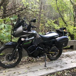
This is an excellent route for beginner and intermediate riders. Be warned, there is a water crossing over Briggs Creek. It was approximately 3’ deep when we crossed today. It is a lot less shallow in the summer.
Views were awesome with sunshine once you get above the fog.
★
★
★
★
★
Collings Mtn trail near Applegate Lk Dam
Trail started on Grouse Creek and headed up the hill. Quickly split off into horse trail paralleling hiking trail. Passes old pioneer-looking roads. Gorgeous Canton Live Oaks with ebony acorns and Douglas-fir forest. At creek crossing, huge-leaved herbaceous plant with twice-pinnate compound leaves and looks like thorns at the base of stem.
Haha, Bigfoot Trap.
Big fungus day!
Short mine entrance with a little bat at the end.
2/3ds of way up trail starts to get BUGGY w gnats—Florida level! Continued for the entire hike and along lake.
The walk along the ridge is pleasant, and the midges have eased off. Great views to the west of Grayback and Sugarloaf, with a closer Steve Peak looking deceptively taller cuz it’s closer.
Coming around the south west side, Incense Cedar, Sugar Pine, and large Manzanita becomes dominant. A peak at Red Butte to the south.
Lunch on top, then back down along the ridge through P Pine and Cedar. Lookin for snakes!
The 3 1/2 mile hike along was not so much fun and I was feeling my feet. At least it was on a trail and not the road.
★
★
★
★
Collings Mtn trail near Applegate Lk Dam
Trail started on Grouse Creek and headed up the hill. Quickly split off into horse trail paralleling hiking trail. Passes old pioneer-looking roads. Gorgeous Canton Live Oaks with ebony acorns and Douglas-fir forest. At creek crossing, huge-leaved herbaceous plant with twice-pinnate compound leaves and looks like thorns at the base of stem.
Haha, Bigfoot Trap.
Big fungus day!
Short mine entrance with a little bat at the end.
2/3ds of way up trail starts to get BUGGY w gnats—Florida level! Continued for the entire hike and along lake.
The walk along the ridge is pleasant, and the midges have eased off. Great views to the west of Grayback and Sugarloaf, with a closer Steve Peak looking deceptively taller cuz it’s closer.
Coming around the south west side, Incense Cedar, Sugar Pine, and large Manzanita becomes dominant. A peak at Red Butte to the south.
Lunch on top, then back down along the ridge through P Pine and Cedar. Lookin for snakes!
The 3 1/2 mile hike along was not so much fun and I was feeling my feet. At least it was on a trail and not the road.
★
★
★
★
Sugarloaf/Grayback Mountain hike
Parked at the O’Brien Creek upper trail head, made it with my Forester but would recommend parking at the lower trail head. That last mile is sketchy for a car. Even a Forester
It’s 8:21 AM, a little late but gorgeous creek hiking up the first switchbacks through Doug-fir, mid 50s temperature.
Quite a few hazelnut trees come with nuts, on the trail, a little green but tasty. Very steep rocky trail at places, OK (not eroded) because it seems to get very little use.
Halfway up starting the switchbacks. Very lush woods, huge Incense Cedars, and lots of new wildflowers.
Very curious, took the path to the left and went to a cabin. With a sign to another cabin in a quarter of a mile.
This side hike took me to lush, wet meadows and is incredibly gorgeous. I’ll have to research what the cabin was used for.
Finally back to the trail, and it’s getting dry towards the top last switch back. Most of the trees are fir, and a lot of blowdown probably from gusty winds from above.
A nice ground creeping fire came up through here sometime ago. Scorching the bottoms of the fir trunks but not killing too many of them at all.
At the top of the switch backs meeting with Boundary Trail it’s clear that the fire actually came down the hill with the high side of the trunk scorched. I took Boundary Trail south fora but through a very wet meadow with many many more flowers
Turning around back north, I made it up to Windy Pass and then on up to Sugarloaf Mountain without too much trouble. Had a little rest, drank some water, and enjoyed the amazing view of Mountains to the South into California like Prescott Peak and The Marbles, even Mount Eddy. Why was this a nice part of the hike? Because there’s a Trail!! Next I thought I would try my luck at bushwhacking Grayback. Not a lot of fun, made it to the first and second false peaks, got a good look at Grayback itself and decided that at 1 PM, I was done and should start heading back.
There’s so much blow down of fir on the Boundary Trail that I am thinking about heading overland down to the switchbacks to avoid it. Decided not too—good choice, and made my way back down to the trail head. Curious assault-looking warrior van in the lot, but no one around. I wonder where they went?!
★
★
★
★
Killer! Paid better attention. Splitrock Trailhead to Wagner Gap goes up 450ish’ and down 750ish’ meaning it’s harder coming out.
Took the Wagner Glade Trail down the road 2060! Steep but well-planned trail. Coming out was tough, but I didn’t really start feeling it till climbing the two hills to the trailhead.
Wagner Glade trail is beautiful! Starts in heavy woods and then drops into a pretty wet bear habitat kind of draw and then back into very old growth woods at road 2060. Huge pines and firs at the road. Saw one biker on the road and a runner on Splitrock
Flat tire at the trailhead—writing this at Les Schwab and hoping they can fix it
Passed up a through-hiker at Callahan’s but couldn’t pick him up :(
★
★
★
★
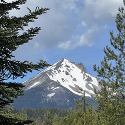
Fun hike with great views. Eventually sharing trail with bikers around Four Corners. Huge pines at the top of the trail and a bear near my car at the end. Logging operation where the trail comes back to the road at the top of the Epstein Property. Don Hamman running the claw
★
★
★
★
Cool hike, a little snow persists at the top of the Corral Creek draw. Clear at the top—visibility to Mt Bailey to Mt Eddy.
Lots of flowers!
★
★
★
★
I forgot how hard this hike is—even Brent and Christopher had trouble negotiating trail down
★
★
★

Unable to reach Crater Lake, we skied along this hiking trail. Really pretty, and wonderful snow.
★
★
★
★

Absolutely beautiful! I brought crampons, a trekking pole, mountaineering axe, plenty of water, an emergency shelter and lots of layers. Def MUST use gps like Gaia to keep on the trail with this much snow. It was only about 6 inches to start but by mile 2 it was solidly a foot of powdery not stompable snow…and then by mile 3 it was ridiculously to my knees of fluffiness, not post holing at all as nothing tamped down. Bring snow shoes! It’s a great alpine mountaineering route finding trail for those with experience! Please either know what you’re doing and have an emergency gps device in case needed OR come with people experienced for these alpine climbs. It was absolutely joyous if you love this kind of thing! And no one at all around for miles!
★
★
★
★
★

The loop is a classic, that’s why it’s an FKT too. You can be super quick on their surface. Some volcanic sections exposed but that go back into tree tree line. Shade. Solid ups and down and some sprint stuff along the final three miles on bike path..
★
★
★
★

Not too many people above Panther Peak on the No Candies Trail or Horn Gap Trail. So close to the Wagner Glade Trail!!
Still quite a few flowers including some higher elevation flowers. Spoke to a Douglas Squirrel and got a lecture from a Mountain Quail about boundaries.
★
★
★
★
Too early for the flower still, but lots of other late spring bloomers. By 2:00, most of the snow was gone. Drove four thru-hikers from Ski Ashland parking lot to the hostel. They were happy to see me and actually were waiting by my car at the trailhead before hiking to the lot
★
★
★
★


Beautiful hike to a remote alpine lake. Lake is not swimmable but very picturesque.
VERY steep grade, but worth the effort.
★
★
★
★

You’re going to posthole even with snowshoes. I’d recommend a start earlier than 6am or bring skis. I ended up losing my snowshoes and a hiking pole on this mountain! If anyone sees a black diamond hiking pole and a pair of highlander elite snowshoes (designed in the French Alps) let me know! Otherwise, the views are great! It’s worth the climb and the postholing.
★
★
★
★

Great 20mi MTB loop. Some challenging lava near Fish lake. Thanks to those who engineered those lava stretches. And the folks who maintain this trail… lots of sawdust
★
★
★
★
★
Rough Forest Service Road.
Rugged country. Better be driving a high clearance, 4WD rig.
★
★
★
★

Attempted to hike this on March 22. The gravel road to get to the trail was snowed in about 11 miles from the trail. But could be managed with a 4wheel drive vehicle. Be prepared for this if coming early. Made it to the trailhead and hiked in 5 miles before loosing the trail because of snow. It was my first time on this trail and was not looking to lose the trail and bushwhack. Also saw bear tracks in the snow about the size of two of my fists decided it was a good time to turn back. Also this early in the season the trail is covered in fallen trees. The two creeks crossings in the beginning miles were manageable if you are willing to jump from rock to rock and get in thigh deep water. Overall the first 5 miles seem very difficult not just difficult. We had one person from the group get a tick and I got poison oak.
★
★
★
★
★



Good hike to do once for the views. Hike is tough as its about 4K elevation gain. It took about 6 hours up and down. Trail is pretty easy to follow. There are a lot of reports of people getting lost. Don’t let this deter you. Just follow the white dots and stay on the ridge. The top section is probably too difficult for dogs. Bring enough water.
★
★
★
★
★

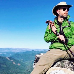
This route into Cliff Lake is steep and rocky. There are better options if Cliff Lake is your destination.
★
★
★

Amazing views from the top but difficult hike. Be comfortable with heights and steep hiking. Bring plenty of water, gps map, bug spray, trekking poles, sunscreen, and food for a 10 hr trek.
★
★
★
★
★
Long gravel road to the trailhead.
Gorgeous hike and views
Wildflowers thick as a carpet.
Complete loop from Seattle Bar to Carberry Creek was 36 miles of rugged Siskiyous.
★
★
★
★
Amazing views of Mt. Shasta and Mt. McLaughlin. Gorgeous alpine meadows and countless distant peaks. Hiked the PCT trail for part of the way.
★
★
★
★
New London Trail isn’t well maintained. This loop includes some road walking.
★
★
★

An awesome hike! Gaia has it rated as a difficult loop, but we found it fairly easy. Some nice climbing, but the trail is very well maintained and even. It has spectacular old growth forest with beautiful views. We went the first week of October and the fall colors were at peak, and we even found a patch of snow on the trail! The big tree is magnificent, but all of the trees are fabulous! Highly, highly recommend this hike! We will be returning for sure!!
★
★
★
★
★
Nice hike with good views. First 2-3 miles is the hardest. Gets easier at trail junction.
★
★
★
★

Such an amazing hanging meadow of wildflowers just a half mile or so from the trail head.
★
★
★
★
★

A few buddies and I hiked 40 miles along the rogue River Trail. We hiked from Graves Creek to Foster Bar. The trail winds along the river the whole way occasionally taking you into the forest and into beautiful open Meadows covered in wildflowers. Along the river the mountain has been carved out and you hike with Cliffside’s on your right and the river below you. If you are afraid of heights be aware the trail can be very narrow in some points and along high cliffs.
The weather was almost perfect with temperatures topping out in the upper 50s and reaching down to mid 40s in the evening. We occasionally had sprinkles of rain and on the second day it did downpour on us while we were setting up camp. Oregon weather in the month of May is very unpredictable. If we would have hiked the same trail a week prior it would’ve been in the 90s.
There was a lot of poison oak so if you plan on hiking this trail be prepared for that. There are also ticks, and bears so come prepared to deal with the wildlife and critters as well. We only saw one or two sites with bear boxes so come prepared to hang your food and consider bringing bear spray.
Many of the toilets along the way we're locked for us but I'm assuming they will be open starting on Memorial Day weekend. Parts of The trail were also not very well kept with downed trees we had to climb over or go off trail to traverse.
★
★
★
★