United States
›
North Carolina
›
Nantahala National Forest (Cheoah Ranger District)

Best Hiking Trails in Nantahala National Forest (Cheoah Ranger District)

21 reviews


link Copy Link
  • facebookFacebook
  • Twitter iconTwitter
  • emailEmail
directions Driving Directions

Seasonal Popularity

Overview

Nantahala National Forest (Cheoah Ranger District) is a national forest in North Carolina.


Resources

  • wikipedia

  • Hiking Trails (67)
  • Reviews (21)
  1. 1
    Joyce Kilmer Memorial Forest via Lower Loop Trail and Upper Loop Trail
    ★ ★ ★ EASY 1.9 mi
  2. 2
    Strawberry Knob via Stratton Bald Trail
    ★ ★ ★ ★ ★ DIFFICULT 11.7 mi
  3. 3
    Strawberry Knob
    ★ ★ ★ MODERATE 6.8 mi
  4. 4
    Nantahala National Forest via Lower Loop Trail and Upper Loop Trail
    ★ ★ ★ ★ ★ EASY 1.7 mi
  5. 5
    Nantahala National Forest via Appalachian Trail
    ★ ★ ★ ★ ★ EASY 3.0 mi
  6. 6
    Nantahala National Forest via Slickrock Creek Trail
    ★ ★ ★ ★ ★ DIFFICULT 12.0 mi
  7. 7
    Nantahala National Forest Loop via Slickrock Creek Trail
    ★ ★ ★ ★ ★ DIFFICULT 12.6 mi
  8. 8
    Cheoah Bald via Bartram Trail
    ★ ★ ★ ★ ★ DIFFICULT 4.8 mi
  9. 9
    Cold Spring Knob Loop via Slickrock Creek Trail
    ★ ★ ★ ★ ★ DIFFICULT 9.8 mi
  10. 10
    Nantahala National Forest via Hangover Lead Trail
    ★ ★ ★ ★ ★ MODERATE 2.9 mi
    user_profile
    mcphobian 8 months, 2 weeks ago
    Track (9/4/21, 2:03:49PM)
    Took longer than anticipated, bee’s were abundant, but overall great hike
    ★ ★ ★ ★

    user_profile
    toddmtnbkr 10 months, 2 weeks ago
    Cherohala forest service road
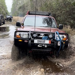
    Great gravel roads. Little traffic Mostly tight pack, fast gravel.
    ★ ★ ★ ★

    user_profile
    uvabarnett 1 year, 9 months ago
    Bartram Trail, Ledbetter Creek to Cheoah Bald
    This is a hard hike. Ended up ~1.5 miles longer than expected. Steep initial climb, levels out a bit around creek camp, then up rest of the way. Plan for extra water given the workout. Slippery rocks and several creek crossings. But beautiful wildflowers, fungi, and views well worth it.
    ★ ★ ★ ★ ★

    user_profile
    honeysuckle 7 months ago
    Track (10/14/21, 2:39:41PM)
    ★

    user_profile
    tlabash 7 months ago
    Yellow Creek Falls
    ★ ★ ★ ★ ★

    user_profile
    honeysuckle 7 months, 2 weeks ago
    Huckleberry Knob
    ★ ★ ★ ★

    user_profile
    chrisskalet 8 months, 1 week ago
    Bob Bald
    ★ ★ ★ ★

    user_profile
    Bailey Kessing 1 year, 1 month ago
    Wolf Laurel Trail to Slickrock Creek Trail
    ★ ★ ★ ★

    user_profile
    Bailey Kessing 1 year, 1 month ago
    Track (4/18/21, 1:23:58PM)
    ★ ★ ★ ★

    user_profile
    jeffg4558 1 year, 1 month ago
    Lake Santeetlah (4/9/21, 10:05:41AM)
    ★ ★ ★ ★ ★

    user_profile
    Ian P. 1 year, 2 months ago
    Bob bald water from junction
    ★ ★ ★ ★ ★

    user_profile
    Ian P. 1 year, 2 months ago
    Wolf Laurel ➡️ Bob Bald
    ★ ★ ★ ★ ★

    user_profile
    dpanchou 1 year, 4 months ago
    Huckleberry Knob
    ★ ★

    user_profile
    The Flying Waltini 1 year, 5 months ago
    15.25 mi 7.30 hrs Jacobs to Cody plus 2 more miles
    ★ ★ ★ ★ ★

    user_profile
    The Flying Waltini 1 year, 7 months ago
    11 mi 6 hrs Simp Gap turnaround Brown shelter and back
    ★ ★ ★ ★ ★

    user_profile
    tim.vivi 1 year, 7 months ago
    Track (10/1/20, 11:39:40AM)Yellow Creek Falls
    ★ ★ ★ ★ ★

    user_profile
    allykarge 1 year, 8 months ago
    Lake Santeelah 8/23/20
    ★ ★ ★ ★ ★

    user_profile
    johnstutz 2 years ago
    SlickRock Hike Out
    ★ ★ ★ ★ ★

    user_profile
    SixthManKid 2 years ago
    Track (4/27/20, 3:30:22PM)
    ★ ★ ★ ★

    user_profile
    SixthManKid 2 years, 1 month ago
    Track (4/4/20, 12:06:07PM)
    ★ ★ ★ ★

    user_profile
    msbalfrey 2 years, 2 months ago
    Ike branch trail 3/22/20
    ★ ★ ★ ★ ★

  • Web App

    • Map
    • Find Trails
    • Upload
  • Resources

    • Hiking & Backpacking
    • Offroad
    • Hunting
    • Mountain Biking
    • Backcountry Skiing
    • Fishing
    • Map Catalog
    • Help & Forums
  • Purchase

    • Individuals
    • Professional
    • Outside+
    • Volunteer
    • Gifts
  • Company

    • Blog
    • Podcast
    • Jobs
    • Diversity
    • Partnerships
    • Media
  • Gaia GPS - Trail maps for every adventure

    Follow Us

    Download on the App Store Get it on Google Play

© Trailbehind Inc. - All Rights Reserved.

  Privacy • Terms

Outside Inc Logo

© 2022 Outside Interactive, Inc.

Outside Inc Logo