United States
›
Nevada
›
Desert National Wildlife Refuge

Best Hiking Trails in Desert National Wildlife Refuge

32 reviews


link Copy Link
  • facebookFacebook
  • Twitter iconTwitter
  • emailEmail
directions Driving Directions

Seasonal Popularity

Overview

Desert National Wildlife Refuge is a protected area in Nevada.


  • Hiking Trails (18)
  • Reviews (32)
  1. 1
    Dead Man Canyon via Hidden Forest Road
    ★ ★ ★ ★ ★ MODERATE 4.8 mi
  2. 2
    Desert Pass Campground via Mormon Well Road
    ★ ★ ★ ★ ★ DIFFICULT 41.9 mi
  3. 3
    Hidden Forest Road
    ★ ★ ★ ★ ★ EASY 3.7 mi
  4. 4
    Hayford Peak
    ★ ★ ★ ★ ★ DIFFICULT 7.0 mi
  5. 5
    Pine Nut Trail
    ★ ★ ★ ★ ★ MODERATE 5.8 mi
  6. 6
    Hayford Peak
    ★ ★ ★ ★ MODERATE 2.1 mi
  7. 7
    Yucca Forest via Mormon Well Road
    ★ ★ ★ ★ DIFFICULT 39.7 mi
  8. 8
    Yucca Forest via Pine Nut Road
    ★ ★ ★ ★ MODERATE 5.8 mi
  9. 9
    Yucca Forest via Mormon Well Road
    ★ ★ ★ ★ DIFFICULT 40.0 mi
  10. 10
    Gass Peak Road Camping Area via Gass Peak Road
    ★ ★ ★ DIFFICULT 16.8 mi
    user_profile
    freightmover02 1 month, 2 weeks ago
    Extended Desert Wildlife Refuge
    Explored some of the side roads
    ★ ★ ★ ★ ★

    user_profile
    freightmover02 1 month, 2 weeks ago
    Desert Wildlife Refuge
    Just a beautiful place to explore not far from vegas
    ★ ★ ★ ★ ★

    user_profile
    CMFB ADVENTURES 5 months, 2 weeks ago
    Alamo Road
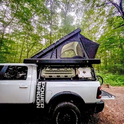
    This was a moderate trail with just a little elevation change. I did this ride late in the day. So half of it was at night. The only real part that was difficult was the lake bead area. Super soft silty sand with big ruts. I would not want to travel that area of the trail in heavy rain. Best part of it is the great views all the way through. Even some cool little dispersed camping spots.
    ★ ★ ★

    user_profile
    bwagner19 10 months, 3 weeks ago
    Mormon Wells Road
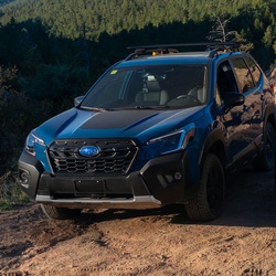
    Quick drive up and over with Andrew, Brenden and Nealy. Gale followed in his Gladiator.
    ★ ★ ★ ★

    user_profile
    Aaron 1 year, 2 months ago
    Gass Peak 4/2/21
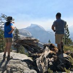
    It is a bit of a drive to get there over a rough road, but I was rewarded with a nice trail. It starts with a gentle slope and becomes steep in places, following a ridge line to the top. There is no shade. At the peak there is an amazing view of the Las Vegas valley, with Lake Mead in the distance to the southeast. To the north-northwest you can see where US-95 heading out past Indian Springs, and the Sheep Mountains are visible to the north. Mt Charleston is beautiful to the west. Peaks in CA, AZ, and UT are also visible when it is clear.
    ★ ★ ★ ★

    user_profile
    Marlon 1 year, 3 months ago
    Mormon Wells Road
    Easy dirt road to camp site near the peak for day camping or overnight. 2wd high clearance vehicle can make it up as long as there is no inclement weather.
    ★ ★ ★ ★ ★

    user_profile
    @thejeepnewb 2 years, 8 months ago
    Yucca Forest via Mormon Well Road
    It’s not one-way.
    ★ ★ ★ ★ ★

    user_profile
    catasco 2 weeks, 5 days ago
    Dead Man Canyon via Hidden Forest Road
    ★

    user_profile
    Cyphro 7 months, 4 weeks ago
    Mormon Well Road - P1:Easy / P2:Moderate
    ★ ★ ★ ★

    user_profile
    vidalsulieman 8 months ago
    Arizona Grand Canyon roadtrip
    ★ ★ ★ ★ ★

    user_profile
    goventure24 10 months, 1 week ago
    Desert Pass Campground via Mormon Well Road
    ★ ★ ★ ★

    user_profile
    bnthawaii006 10 months, 4 weeks ago
    Corn Creek Dunes via Alamo Road
    ★ ★ ★

    user_profile
    Jack 1 year ago
    Track (6/5/21, 11:48:32)
    ★ ★ ★ ★ ★

    user_profile
    simba5791 1 year ago
    Yucca Forest via Pine Nut Road
    ★ ★ ★ ★ ★

    user_profile
    djasper82 1 year, 2 months ago
    Track (4/19/21, 6:59:21AM)
    ★ ★ ★ ★ ★

    user_profile
    surfmutt 1 year, 2 months ago
    Hidden Forest Road
    ★

    user_profile
    antti.kiesi 1 year, 3 months ago
    Alamo Road
    ★ ★ ★ ★ ★

    user_profile
    mwilson920 1 year, 4 months ago
    Mormon Well Road 2.0
    ★ ★ ★ ★

    user_profile
    a.berthoux 1 year, 7 months ago
    Yucca Forest
    ★ ★ ★ ★

    user_profile
    bmurraylv 1 year, 7 months ago
    Alamo Road to Cabin Springs Nevada
    ★ ★ ★ ★

    user_profile
    negative50 1 year, 9 months ago
    Mormon wells R.D. with pine nut camp spur
    ★ ★ ★ ★ ★

    user_profile
    YETICLOAK 1 year, 10 months ago
    Yucca Forest via Mormon Well Road
    ★

    user_profile
    SoWhyDon’tYou 1 year, 12 months ago
    Phisgagh
    ★ ★ ★ ★

    user_profile
    camacho1178 2 years, 2 months ago
    Mormon Wells Rd
    ★ ★ ★ ★ ★

    user_profile
    mbshelly 2 years, 2 months ago
    MWR with Alisha Full
    ★ ★ ★ ★ ★

    user_profile
    quimsonm 2 years, 2 months ago
    Yucca Forest via Mormon Well Road
    ★ ★ ★

    user_profile
    @thejeepnewb 2 years, 2 months ago
    Track (4/5/20, 12:32:37)
    ★ ★ ★ ★ ★

    user_profile
    mbshelly 2 years, 3 months ago
    Mormon Well Rd to Camp Ground
    ★ ★ ★ ★ ★

    user_profile
    popnsmoke242 2 years, 5 months ago
    Track (1/18/20, 10:25:26AM)
    ★ ★ ★ ★ ★

    user_profile
    Tara 2 years, 6 months ago
    Alamo Road
    ★

    user_profile
    RubiHog 3 years ago
    Track (2/24/19, 11:21:35AM)
    ★ ★ ★ ★ ★

    user_profile
    bknorpp1 3 years, 1 month ago
    Mormon Pass, Clark County to Sky Pointe Drive, Las Vegas, NV, USA
    ★ ★ ★ ★ ★

  • Web App

    • Map
    • Find Trails
    • Upload
  • Resources

    • Hiking & Backpacking
    • Offroad
    • Hunting
    • Mountain Biking
    • Backcountry Skiing
    • Fishing
    • Map Catalog
    • Help & Forums
  • Purchase

    • Individuals
    • Professional
    • Outside+
    • Volunteer
    • Gifts
  • Company

    • Blog
    • Podcast
    • Jobs
    • Diversity
    • Partnerships
    • Media
  • Gaia GPS - Trail maps for every adventure

    Follow Us

    Download on the App Store Get it on Google Play

© Trailbehind Inc. - All Rights Reserved.

  Privacy • Terms

Outside Inc Logo

© 2022 Outside Interactive, Inc.

Outside Inc Logo