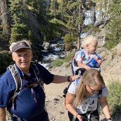
Such a beautiful short hike with plenty of wildflowers to keep your eyes entertained if the views weren’t enough. My dog and I started our hike at our campground Edna creek around 9 AM, took us about an hour or less to do the small loop. Since this trail is shared with equestrians, there was horse poop along the trail, but nothing major. Overall, the trail was very well maintained until the last bit. Overgrown, muddy, and flooded some areas. 4/5 ⭐️
★
★
★
★

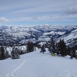
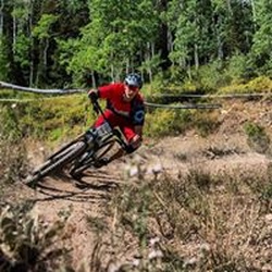
A beautiful springtime hike with expansive views when you reach the ridge and on the descent. The trail is used by motorcycles and is in very good shape. Steady long uphill followed by a steep descent to the middle fork of the Boise river. Cooler temperatures and some wind and rain on the ridge and descent. It was a Wednesday and didn’t see anybody else on the trail. Remnants of an old homestead about 2 miles in, with roses, lilacs and non-native trees planted by those hardy folks of yore.
★
★
★
★
★

This is a great hike with stunning views of the Boise river canyon from the top of Little Fiddler.
★
★
★
★
★


If your in Boise and looking for a fun hike, the Stack Rock lollipop of 12 miles is a nice
★
★
★
★

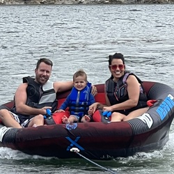
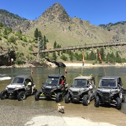
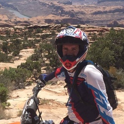
This was not a hike. We were in a RZR 1000 and had a great time. This was a fairly easy out and back ride from Edna Creek to Jackson Peek to Graham where you can splash in the North fork of the Boise river to cool off. We did have a few stops to eat and hydrate and I forgot to pause the track so the ride would have taken 4.5 hours approximately if we hadn’t stopped.
★
★
★
★

Freddie main parking to Connie and Eastside intersection. Then Mr Big yo Sinker Creek. Climb to Eastside and continue to Bogus Basin recreational area. Take deer point trail and continue to elk meadows. Use the face trail to summit Shaffer butte via tempest. Loop back
★
★
★
★
★
Freddie main parking to Connie and Eastside intersection. Then Mr Big yo Sinker Creek. Climb to Eastside and continue to Bogus Basin recreational area. Take deer point trail and continue to elk meadows. Use the face trail to summit Shaffer butte via tempest. Loop back
★
★
★
★
★


Great hike. Pretty easy. Went in about 4 miles. There were a lot of stream crossings with the first three having a bridge.
★
★
★
★
★

Very remote! Saw 1 mountain lion and no people in middle 10 miles. Trail sketchy but a good hike.
★
★
★
★


Gnarly double track with a lot of downed trees and closed trails.
★
★
★
Overlanding route/F150/Road blocked at easternmost point by concrete barriers. CAO 11 May 2019.
★
★
★
★