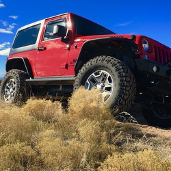
Road is moderate at times however a 4x4 with good clearance will have no problems. Outstanding and breathtaking views!
★
★
★
★
★

Couldn’t get to the view at the end of the hike due to snow covered scree.
★
★
★

No lack of water, I went counterclockwise. Wet and cold until climbed into sunlight. Gorgeous meadows and open areas. Added Comanche peak to route. Nice views continued throughout. Multiple creek fordings and trail segments that water drainages
★
★
★
★

A nice hike. Trail 800 has some great views. 832 headed towards Table Mountain had beautiful views. I had to turn around because my fear of heights got me crossing to Table. 832 going the other direction was mostly in the forest. Flowers were pretty, but there weren’t many views outside of the forest until I got close to the forest service road that I took back to the trailhead.
★
★
★
★
The 4 pens at the Stock unloading area were in good shape, and the creek water for the horses was nearby. The stock trail #817 was hard to find with only two carsonite posts to mark the way. After about .7 mile, we had to go a short distance on the road, then crossed the bridge and followed the horse trail signs to the right to begin the trip after signing in. The Weimenuche Wilderness was beautiful. The trail was in very good shape. Squaw lake was very nice, but non luck with the fishing.
★
★
★
★
★

Yeah, we didn’t hike so I’m not not giving no reports. This is a freaking great offloading spot though though.
★
★
★
★
★


The fall color here was great and I had the trail entirely to myself. There are a few times the trail comes and goes but it’s easy enough to find your way. One of my best fall hikes to date!
★
★
★
★
★
The fall color here was great and I had the trail entirely to myself. There are a few times the trail comes and goes but it’s easy enough to find your way. One of my best fall hikes to date!
★
★
★
★
★
The fall color here was great and I had the trail entirely to myself. There are a few times the trail comes and goes but it’s easy enough to find your way. One of my best fall hikes to date!
★
★
★
★
★

Long hike with extended mileage on the Mesa which wasn’t very interesting. The descent into whale creek was fun. Had to continue backpacking to the main stream to find water and a relatively flat area to set up camp
★
★
★
★

Great ATV trail! Easy trails, great scenery, and a moose. Finished in the Creede mining district.
★
★
★
★
★

From the parking lot it’s just short of 4 miles to Duck Lake. Good climb and beautiful scenery. Worth it for sure.
★
★
★
★
★

Tucker Ponds are located off the road between South Fork and Wolf Creek pass. We rode the trails all the way to Platorro lake.
★
★
★
★
★

Overnighted the trail at the second meadow. Beautiful views, plenty of water and wildlife. The trail is a bit longer than I thought it might be but still doable in a day for sure
★
★
★
★
★

Beautiful hiking trail! However, I would rate it intermediate as it is a steep climb from the parking lot to the intersection of the lake trail.
★
★
★
★
★
Overnighted the trail at the second meadow. Beautiful views, plenty of water and wildlife. The trail is a bit longer than I thought it might be but still doable in a day for sure
★
★
★
★
★


Beautiful view of Regan Lake. Fun hike on Elk trails. Decent was very rocky and slippery. Overall great hike.
★
★
★
Beautiful view of Regan Lake. Fun hike on Elk trails. Decent was very rocky and slippery. Overall great hike.
★
★
★

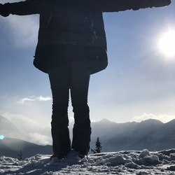
We call this Tianna’s Run because she discovered this sick line through the trees. Try it and you won’t be disappointed! 😘🏂🎿⛷❄️
★
★
★
★
★


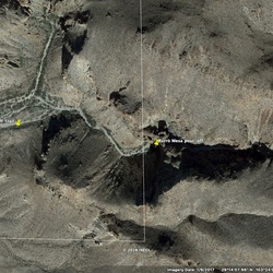
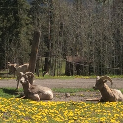
I rate this 5 stars based on the views you have of the Rio Grande River Valley and the surrounding mountains that make up the Creede Caldera. Usually you will encounter a herd of Big Horn Sheep in the upper elevations of the trail but we didn’t encounter any on this trip. Take the side trip up to Crystal Lake if you have the time. It is a beautiful little alpine lake. The trail is well graded for the first 8 miles to the fork where it splits to go to Bristol Head or to Crystal Lake. From the fork the road becomes less well graded and rough but nothing that a higher clearance vehicle can’t handle. About a quarter mile from the summit, the trail becomes very rocky for a short stretch. Slow speed and tire placement will get you through the rocky section without problems. The only detractor of the trip is that you have to come down the same way you came up. Make the time to stop and see North Clear Creek Falls. You will not be sorry you did.
★
★
★
★
★


Hard for Jack even with boots becuz it is pretty rocky. Many pretty views but east side of mountain covered with dead trees
★
★

Really nice hike around lake and along side of mountain. Easy to miss left turn at one mile mark. Signage gone. If you start up a mountain there and encounter another big trail sign , go back 30 yards and look for small trail now to the right
★
★
★
★
★


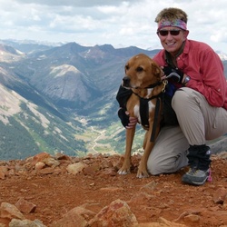
Awesome, epic, so much to see. Goes up to 12,218 ft. Great views. Very technical in places. Some pretty long climbs. Loved it!
★
★
★
★
★
Left Platoro on breakfast trail. About 1 hour to the top and first road. 10 minutes across to Kerr lake road then up a rocky steep road to Kerr lake for just less than 1 hour. Entire trip just under 2 hours.
★
★
★
★

Easy hike. Reset one of the American flags, saw a snake and a cool waterfall that was blowing the water back up over the top, not down. Icicles too.
★
★
★
★
Traditional family hike that has gotten harder after the fire went through. Lots of deadfall.
★
★
★

I’m a low lander, but in better shape than most and the first leg of the hike up from Creede is a challenge. I stopped several time to let my HR catch up. The trail is steep wear stable shoes. The views are great, only saw one person.
★
★