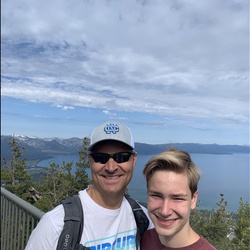
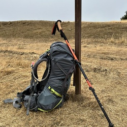
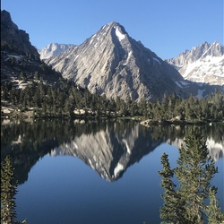
Amazing feeling to be out on the JMT with no one there. This time of year is arguably the best because of traffic and no mosquitoes
★
★
★
★
★

Nice hike with well established trail. We only did a mile out and back. Beautiful views of Wishon!
★
★
★
★
★

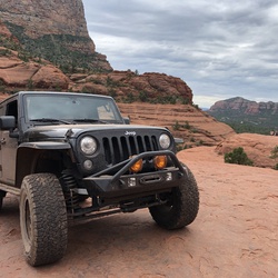
This ride is a huge loop which begins at the paved Tamarack Sno-Park staging area. The first part consists of a fast run down the main road which can see some traffic so, stay on your side of the road and use hand signals with oncoming vehicles. There is then a rocky climb up Bald Mountain. The climb is worth it! Also, scaling the fire lookout is a must. The view looking down on the entirety of Shaver Lake is impressive.
After that you drop off the back side down into Rock Creek. There are a couple formidable obstacles. Teeter-Totter is optional but the drop into Rock Creek is mandatory. After you conquer those, you climb back out of the creek and up to Base Camp. You then loop clear back around to the South Fork of Tamarack Creek. You can see fish from the wooden bridge when crossing it and there is quite a lot of high speed driving getting there.
Continue and you will enter the Creek Fire burn scar, which is impressive, but has frequently falling trees. Finally, you arrive back at the Sno-Park. There are vault toilets at both Tamarack Sno-Park and at Base Camp.
★
★
★
★
★
Good double track trail. Plenty of parking at the trail head. Just under 2 miles one way to the water.
★
★
★
★
★


It’s gorgeous. Absolutely beautiful. The hike itself wasn’t necessarily easy. there’s a lot of rocks and it’s definitely on an incline all the way up. But it was fun and challenging.
★
★
★
★


Completely deserted, but also closed. Wanted to check snow situation for future hikes. At this time there are only occasional patches in shaded areas.
Sky Ranch road (632) clear to Soquel meadows. After that, snow in shaded areas.
★
★
★
★

R E L E N T L E S S
Definition: see Dusy-Ershim trail.
Seriously ?!? This was 30 miles of boulder after boulder after tight spot between trees after boulder. Make a point to get to the meadows to see the lakes. They are gorgeous. Might want to bring an extra 5 gal of gas too.
★
★
★
★
★

This hike is my first trail created during the Covid-19 pandemic. Created over several months using a Mcklntock and various hand tools.
★
★
★
★

Raw, vast and with new beauty each day. Blessed to have had the opportunity to walk through this magnificent part of the Sierra Nevada.
★
★
★
★
★

Amazing views of post fire backcountry. Follow pink ribbons in the trees for best Jeep route to the weather station. The weather station is unmanned, in a large clearing suitable for camping.
★
★
★

This is my baseline hiking activity. Medium workout if I jog down. Good for legs and aerobic
★
★
★

Unfortunately, the first two miles of the hike goes through the recent 2020 creek fire burn. I started the hike late in the day but it wasn't too hot yet. Once you get to the Niche, most of the burn stopped and you have the pleasant views of Granite Creek and the surrounding peaks. The lakes were nice and cool but a fair amount of mosquitos. Very small patches of snow around the lake.
★
★
★

Awesome uphill crawl ... incredible scenery ... moderate undergrowth encroachment on the trail ... highly recommend it if you love Forest roading ...
★
★
★
★
★

Great, long hike in November 2020. We found several ticks on our dogs afterwards though so dog owners beware.
Don’t go in the summer. Too hot and the gnats make it pretty unbearable.
There’s a closer entrance off teaford saddle rd. for a shorter hike.
★
★
★
★

Quite passable first leg of hike from John Muir Ranch to Ward Lake ... need to work out rest of trip
★
★
★

We had a great time on this trail. The adventure started with the drive up. It’s a one way road for about 8 miles and the last couple are unpaved and rough. The hike isn’t 3.5 miles. That will get you there. Start early so you have plenty of time. We’re old and go slow. We didn’t make it all the way this time and we will try it again and start earlier. I’ll rate again when we go again. The app is great to have so you can see your progress. I was told by a fellow hiker to stay Right when you get to the big rock then follow the sign around to the left.
★
★
★
★

Nice trail. Great views. Fun to drive and it didn’t have any crazy obstacles. It looks like it can get pretty muddy some times in the year. Went through in July and everything was dry and easy. Great for beginners. Went through in a stock 2017 Jeep rubicon jku. Around half way you’ll pass a trailer with some wildly aggressive dogs that will chase. Swore I saw a grave in front of the house. Everything just looked creepy right there. Drove past it quickly and stayed on trail. Other than that it was fun.
★
★
★
★
We did not make it to the lake or the trail. After driving for an hour and a half from Clovis. We encountered a locked gate and still had 3.5 miles to get to the lake and trail. We did meet some people who were on their way back from there and advised us not to go since it was only going to get hotter and the way back would be difficult because of that.
Very slow mostly one way road. Be prepared very curvy.
★
★


This is an awesome section (4) of the CAT California Adventure Trip. Nice mix of dirt roads, gravel, and payment. Bigger bikes can do it, should have knobby tires though, fun big not to technical.
★
★
★
★
Trail is not difficult ... the scenery is worth the effort ... 33’s or larger IMO
★
★
★
★

Driving OHV in a Jeep. This is a fun drive to the top of Shuteye. You need a high ground clearance 4x4 vehicle to make it to the top. Great camping spots along the way. Easy to make it to the start of the climb with 2WD in a truck or SUV.
The manned fire look out tower at the top is cool and some really beautiful views
★
★
★
★
Trail is 4x4 advisable... off camber ... steep grades with rock/sand ... some tight switchbacks ... trail peak is 8990 ft ... scenery is 10 of 10
★
★
★
★
★
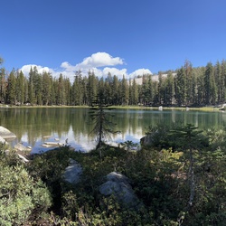
We did a 2 night backpacking trip to George Lake. The trail was great with no snow just some small creek crossings.
★
★
★
★
★

This was our first time on the Perimeter Trail. We water do go south down Lily Trail but took a wrong turn by the logs. Returned almost the way we should.
★
★
★
★

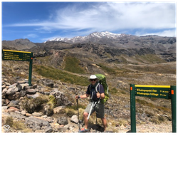
Best 25 days of my life! I did the John Muir 22 years ago, and will do it again this summer!
★
★
★
★
★

Indian Pools above China Peak. Pay close attention for the trail or you will end up climbing rocks, which is fun, but can be tough with a backpack or kids. The trail is beautiful and fairly easy.
★
★
★
★
★
1.6 miles on a well marked trail. Perfect for kids and non-hikers.
★
★
★
★
★

Florence lake is absolutely GODS country. One of the best rides I have ever taken. Also the fishing was outstanding. Truly one of nature’s best places
★
★
★
★
★
This is a forest road between Bass Lake area and Central Camp and goes through Whiskers Campground. There are many trailheads along this road and there are a few cars going up and down hill to watch for
★
★
★
★

 stars
stars
I wrote the description above. It gets 4 stars because it's just a great trip that I've done twice. It loses 1 star only because you have to use the shuttle system at Mammoth and because of the distance. I don't know why the track shows what it does. Here's mine: https://www.gaiagps.com/public/6UaTRoudg7dkPL7mOkkOYSZF . Do note that I recorded this route leaving, so it goes from Iva Bell to the trailhead. Distance is 12ish miles with about 2,000 ft gain/loss on the round trip.
★
★
★
★


 stars
stars