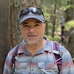
Manzanitas were in bloom and came across a Coastal California Kingsnake.
★
★
★
★
★

Solo day hiked Fri 1/3/25 – This is a nice out and back route on the longer side that starts by taking the South Ridge Trail up to Tahquitz Peak, offering a very scenic, more direct and less traveled alternative to the Devil’s Slide route. Since the weather was nice, I started from Tahquitz View Drive instead of the South Ridge Trailhead to add a few extra miles. Shortly after passing the fire lookout, there is a nice stretch of the Pacific Crest Trail that provided great sunrise views on the way to Saddle Junction with brilliant reflections off the surface of the Salton Sea. From here to San Jacinto Peak, the Chinquapin and Whitethorn bushes along the Wellman’s Cienega and Peak trails have been clipped back nicely by the San Jacinto Trail Report and other volunteers to allow a snag-free passage. I met a few backpackers coming back from a stay in Little Round Valley who were surprised by the lack of snow (like the rest of us) which is amazing for January. From the San Jacinto peak summit, the views were very clear and panoramic, most notably in the northern direction toward San Gorgonio Mountain and the Whitewater/North Palm Springs area. Heading down the Peak Trail, the views toward Cornell Peak and Round Valley were on par with those from the summit. Stopping at strongly flowing Wellman Cienega for some very cold, refreshing water was a nice break before returning to Tahquitz Peak. While the fire lookout was closed, it provided the perfect platform for a lunch break with even more stellar views to the south and east. After trading a few stories with some climbers, I headed back down the South Ridge Trail which is even nicer in the afternoon sun with South Peak and Antsell Rock brightly lit. If you hike in the San Jacinto Wilderness area, I strongly recommend checking the San Jacinto Trail Report (https://sanjacjon.com/) before going for the latest trail conditions, especially in winter. Logged 22.7 miles / 6355 vertical ft with Gaia
★
★
★
★
★

Beautiful day. Didn’t make SJ peak, but did this loop with a turn around at Wellman’s Cienega. Lots of different terrain and LOTS of elevation.
★
★
★
★
★
Hiked/Climbed March 13 2026 – As it was forecast to be one of the hotter days of the record breaking March heatwave, I decided on a shorter trip (or so I thought) to climb Antsell Rock with a very early start from the Spitler Peak trailhead. Spitler is a nice trail to get up to the Pacific Crest if not done in the heat (no shade) and you don’t mind the usual deadfall obstacles on the upper switchbacks (4 large cedars to go over/under/around and tangled webs of smaller burned oaks). While it was already warm at the start, a nice cool wind started blowing halfway up the switchbacks and continued for most of the day. Gaining the ridgeline at the Spitler/PCT trails junction in the dark and looking down at the Coachella Valley lights that stretch for miles was amazing, well worth the hike in itself. Continuing north on the PCT, I headed up the meandering gully use trail to Apache Peak, stopping once again to see the eastern light show. Instead of back tracking to the PCT, I decided to spike up and make a direct descent down the snow on Apache’s northern slope to rejoin the PCT (when snow free, there is a use trail here). Back on PCT heading north, the occasional snow was still firm as first light was coming over the horizon. Getting to see the first light from the eastern side of San Jacinto & San Gorgonio is probably the biggest motivation for starting early (IMHO) and it was spectacular. Leaving PCT and going up the northeast chute to reach the base of Antsell Rock started on slippery snow and transitioned to a loose talus/scree mix, just as anticipated. After reaching the base of the first chimney climb, it was a truly fun route up that I has last done in 2024. The ledge connecting the two short vertical routes still had Poodledog bush that was hard to avoid but it is finally withering. I was amazed that there were only three entries in the log book since my 2024 scratching as it’s not a hard climb and rewards one with awesome panoramic views in every direction. After down climbing to the top of the chute and descending it, I decided to expand the day as the weather was still not too bad and I had brought 4 liters of water with plans to cache half of it enroute. Heading back south on the PCT, I took the standard route around the northeast side of Apache which is the first time in three years that it was not steep ice at mile 169 on the PCT map. Continuing on to the south, I decided to go up Apache’s east peak before heading back to the Spitler/PCT junction and going further south to head up the last bit of the Spitler Peak Trail to the summit. After enjoying the great views of Garner Valley, Lake Hemet and the taller San Jacinto peaks, I headed back down to the trailhead, stopping to filter some nice cold water at the bottom of the switchbacks. The lower trail was definitely on the hotter side but still enjoyable with a boonie hat. It is possible to take the Apple Canyon Trail down from the PCT between Antsell and Apache but it’s quite an adventurous bushwhack as I found out in 2024, slower than the extra mileage of returning via the Spitler Trail. “Friday the 13th” was on my side all day! Logged 16.9 mi /27.2 km & 4421 ft /1347.5 m with Gaia
★
★
★
★
★
Solo hiked Fri 6/14/2024 – Decided to create a loop by taking the Spitler Peak Trail up and the Zen Center - Apple Canyon Trail on the way down with stops on the Apache Peak & Antsell Rock summits. Ascended Antsell on the northeast gully route and descended via the northwest ridge. It was great weather going up Antsell Rock, providing for spectacular views off the summit. Coming back from Southwell Peak during the first week of March, I climbed the NE gully route on ice/snow up to the notch before running into a very shiny verglas coating on everything above the notch. Going up the gully this time was nice with careful routing to avoid launching any rocks down towards the PCT. The class 3 sections up to the summit were fun but short lived with some Poodle Dog bush to avoid at all cost on the second class 3 section and even more prolific on the way down the northwest ridge. Scrambling the northwest ridge on the way down was great fun but time consuming. A quicker option would be to traverse down along the west side of the ridge to reduce the scrambling work (but what fun would that be). Once heading down the Apple Canyon return trail, I followed a Peakbagger GPX route that sent me into extreme, shoulder high bushwhacking mode in two places. There were cairns/ducks marking a slightly overgrown trail going down that I should have stayed on but I kept thinking that the bagger GPX would lead to the proper creekside trail which it never did. Lots of time wasted here going through buckthorn and trying to avoid poison oak thickets before getting back on the better trail above the Zen Center. My advice to anyone going up Apple Canyon would be to pick up the trail at Zen and use the cairns with careful route finding between them. Otherwise, just use the Spitler Peak Trail that Jon King and the San Jacinto Trail Report has recently cleared of 30+ blow downs/tree limbs. Spitler might be a longer route to access the PCT but it’s a more enjoyable one with no private property to deal with. In spite of my travails coming down Apple Canyon, it was a very enjoyable hike that just took longer than planned. Logged 12.0 miles / 3318 vertical ft with Gaia .................................................................................................................................................................................................... Solo day hiked Tues 3/5/2024 – Even after a few days of rain, the Spitler Peak and PCT trails were relatively dry and in great shape up to Apache - a few blowdowns and rime ice piles but no real mud. But of course things changed quickly on PCT at mile 169.5, north east of Apache where the steeper slopes were iced over with the snowfall having sloughed across the trail before the freezing rain iced over all of it. Good day for auto crampons for the “crampon/crampoff” march out to South Peak. Same 45-55 degree ice slopes as those encountered last year, here, and at Baldy/Cucamonga where there’s a long runout and very little chance of self-arrest, even with the best axe and technique. There were 3 traverses like this to be carefully crossed 2X, slowing things down a bit. The rest of the way along PCT out to South Peak had so many blowdowns over 4.5 miles that I lost count after the first 20. Most were at the 3-1/2 foot high level with multiple branches where it’s just as hard to crawl under with a winter climb pack as it is to hop over. Some had to be widely bypassed upslope for extra fun, 2 were cleared for extra credit. After getting near mile 174, there was a 2-1/2 foot diameter tree perched above the trail so I directly ascended the east slope of South Peak from there, relaxing fun with little snow. Awesome views from South Peak of Garner Valley, Tahquitz, Red Tahquitz, Antsell Rock and the desert floor. Had some fun bouldering at the South Peak/Antsell Rock saddle on the way back before climbing the east gully route to Antsell Rock which was still frozen enough to front point all the way up to the rock base. That’s when I noticed how shiny the rocks were with a nice, clear, verglas layer of ice still being actively chilled with the wind picking up. Easy decision to bail and descend back to the PCT and back to Apache. Was glad to cross the ice fields before dark and then go up Apache Peak to see the Palm Springs light show and last of a beautiful sunset. I had read Jon King’s always meticulous San Jacinto Trail Report before the trek and knew about the ice but didn’t plan on all the blow downs. Incredibly long day with some brutal stretches but still a lot of fun. Highly recommend Jon King’s incredibly detailed daily reports, https://sanjacjon.com/, and YouTube channel before heading out in the SJ Wilderness. Logged 20.0 miles/4374 vertical ft with Gaia.
★
★
★
★
Hiked Fri 07/07/2023 solo – Early start on a warm day with clear weather on the way up Tahquitz, Grey Tahquitz, Red Tahquitz and Sam Fink Peaks. Enjoyed the awesome panoramic views from each. Chose the harder but very fun scramble up the north side of Grey Tahquitz instead of the optional (and less stressful) use trail to Red Tahquitz which I used for the return to the PCT. Took the very scenic, fern lined Tahquitz Valley Trail to connect with the east bound Willow Creek and King Trails to get to Willow Creek proper. From Willow Creek out to Sam Fink Peak, I tried to use the Caramba Trail which is a total mess, having dense overgrown sections of White Thorn & Chinquapin, combined with several fallen trees hidden underneath. There are several cairns that lead part way though the overgrowth but the trail is non-existent in several sections. While it undoubtedly took more time, I found it easier to navigate a cross country route between Willow and Tahquitz Creeks on the way out to Sam Fink Peak than piece together some parts of Caramba. Lots of fun scrambling up the false summit on Sam Fink before the steeper scramble up the real summit. Filtered nice cold water from Tahquitz and Willow Creeks to make a long, warm day more pleasant. The bugs were out in force by mid-morning, ignoring my insect repellent but held back by a mosquito net. Sam Fink is on the eastern edge of the SJ Wilderness but a fun climb. You just have to carefully plan your route after Willow Creek. To get to Willow Creek (which is very scenic right now), I would recommend using the King Trail instead of continuing further down the Willow Creek Trail. The King Trail is a right turn from the eastbound Willow Creek trail, 1 mile from Saddle Junction. It is well maintained and meticulously marked by many cairns. Route for this hike = Devil’s Slide to PCT southbound to South Ridge Trail to Tahquitz Peak. South Ridge Trail (north) to PCT southbound, scramble p north face of Grey Tahquitz Peak. Animal use trails to Red Tahquitz, returning to PCT northbound via Red Tahquitz Use Trail. PCT to Little Tahquitz Valley Trail to Willow Creek Trail to King Trail to Caramba Trail + cross country to Sam Fink Peak. Return by same path to Saddle JCT, then Devil’s Slide. Logged 23.3 miles/5514 vertical ft. with Gaia
★
★
★
★

First time up to Idyllwild. Stopped by the ranger station right off of the main road and down the way from the trailhead. Picked up a hiking permit for the day. They have a kiosk outside that makes it easy to find and fill out the permit. Trailhead was easy to find. Plenty of parking on a Friday at 7am. The hike up to the junction was a nice and steady incline with some amazing views and a couple of small stream crossings. Once up to the junction it really opened up and the trails flattened out. Tried to go to Tahquitz Peak, still plenty of snow left on the trails as well as a number of downed trees. Turned around about a third mile from the peak, didn’t want to chance it even though I had micro spikes and poles with me. Decided to walk around the meadow, which needed up being really nice. Easy to find forks in the trails with each trail being labeled with signs. The meadow had a number of downed trees and really could use some maintenance but easily enough to be able to navigate over or around them. On the way back down to the parking lot, I was stopped by a ranger asking for permits. Super friendly and knowledgeable about the area. Definitely will do again once the snow melts and the peak is clear to get to
★
★
★
★
★


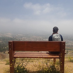
Hike up to two peaks that are connected by the PCT. Great views on both sides but snow on the north face of the Desert Divide stopped further hiking
★
★
★
★