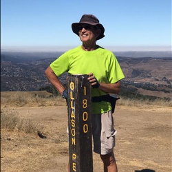
Great hike to get in a lot of elevation gain in a short distance. Start out straight ip Back Creek and return down Meridian Ridge to Hetherington. About 6.5 moles snd a little over 2000 ft elevation gain. Footing is tricky on both Back Creek and Meridian Ridge. Poles highly recommended.
★
★
★
★

We enjoyed this hike a lot. Tons of native flowers, 2 non poisonous snakes, thousands of ladybugs in flight, and colorful butterflies. Some water flowing, good workout.
★
★
★
★
★
This is the really long way to do the Falls hike. Regency trailhead is much shorter. This is a bit over 8 miles and almost 1700 ft of elevation gain. Technical in spots, so don’t plan on a fast pace. Best falls hike is to go counter clockwise…start up Back Creek. Better footing route.
★
★
★
★
Lovely ramble through the low scrub oak of the east bay. Dry and hot conditions.
★
★
★
Great hike to get a lot of elevation in short mileage. Go up Backcreek and down Meridian Ridge for most shade and best footing. Bring poles….trails are full of loose stones. Total elevation gain about 2000ft.
★
★
★
★
If you want a workout in a short distance, this hike is for you. Up Backcreek Trail, which provides shade and wildflowers in season. Return via Meridian Ridge, which will also feature nice wildflowers in season. Bring poles. Both the ascent and descent feature loose rocks and scree. About 2000 ft elevation gain in a 6 mile hike.
★
★
★
★
★
Great hike. Some tricky footing and scrambling due to washouts from last winter.
Wide variety of terrain and nice views. This January hike also featured ladybugs and early season wildflowers.
★
★
★
★
Really nice hike. Trails are free of sticky mud. On a clear day there are spectacular views in every direction from several trails.
Be prepared for changeable weather conditions in and around the summit.
★
★
★
★
Great cool weather hike. Go up Back Creek and return via Mitchell Canyon. Heavy rains will make the trails impassable due to stream crossings.
★
★
★
★
This is a”Badge of Courage” hike. You congratulate yourself that you survived….
★
★
★
★
Middle Trail is really pretty. Over 2000 ft of elevation gain with some technical trail sections. Poles recommended. Beautiful views from the higher elevation points.
★
★
★
★
This hike actually goes outside park boundaries to land owned by Save Mt Diablo. A bit overgrown in spots so tick spray / long pants advised. Nice to hike in new territory!
Total distance 6 plus miles and about 1100 ft elevation gain.
★
★
★
★
Started with the Mitchell Canyon side since it’s quicker and I didn’t know how the prior day’s rains would affect the trail. Made it to the summit rather quickly, so I was able to add on North Peak before heading on down to Eagle Peak and back to the Mitchell Canyon entrance.
Trail conditions were excellent for the most part, except for a few muddy stretches on the Eagle Peak trail, especially near the bottom. There was a lot of ice and frost, in some areas even into the afternoon, so this was a very chilly hike! The creek was dry until about the second mile, where it began to have a trickle and a few small puddles, but after these next few rainy days, there may be enough water to reach the park entrance.
I only took 1.5 liters of water, but should’ve had more. With the addition of North Peak, this hike came in at right about 15 miles with a little over 4000ft of elevation gain.
★
★
★
★

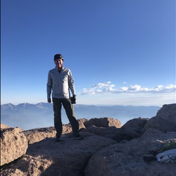
Dig some online research to decide on this trail which includes lots of variety in geology, bird life, wild flowers and broad vistas. Arrived at the South Gate at 8am (when the booth opens) and parked near the Juniper Campsite. Recommend going counterclockwise around the loop, starting by heading for the summit on Juniper Trail (has some steep sections). The Summit Trail comes off the parking lot below the summit tower parking lot, crosses a hillside covered with red chert gravel and rocks before becoming the North Peak Trail. From Prospector’s Gap, the Bald Ridge Trail is a narrow path up that winds up on a ridge with great panoramas to the East and North. Head downhill through manzanita thickets then Head west on the fire road toward Deer Flat Road with woods of old blue oak. The final section is uphill, a little steep in places, but flattens out before you reach the Juniper Campsite.
★
★
★
★
The hills are vibrantly green and the Indian Warriors are just starting to bloom. The falls aren't super full due to our dry January, but all the creeks are running. A gorgeous day with lots of hikers -- this area has gotten quite popular over the last few years. I love this hike and have done it many times -- for me, the just right combination of length, elevation gain, and stunning local beauty.
★
★
★
★
★


I’m giving this trip 5 stars because I finished it. Lol
We did this in less than 3 hours at the END of our work days. It was definitely a tough one, but the view was incredible. First mile is easy compared to the middle two. Definitely bring poles, it is STEEP with loose dirt in many spots (would have died without them). Long light pants are probably a good idea with the amount of poison oak on the trail. All in all a good short/tough hike. If we started earlier, definitely would have felt motivated to climb all peaks. The view from the top is incredible. Don’t forget to grab a beer and burger at Ed’s Mudville Grill after, you’ve earned it.
★
★
★
★
★

 stars
stars
Wonderful hike this time of year. Great views while climbing up to Eagle Peak. One of the best trails to see Coulter Pines and contrast with Grey Pines. Saw numerous wildflowers including many Mount Diablo Globe Lilies on Back Creek Trail
★
★
★
★
★

Lots of quail, turkeys, waterfalls, and a clearly marked trail. Decent shade but very hot in summer.
★
★
★
★
★


 stars
stars


 stars
stars


 stars
stars