United Kingdom
›
North Yorkshire
›
North York Moors National Park

Best Hiking Trails in North York Moors National Park

7 reviews


link Copy Link
  • facebookFacebook
  • Twitter iconTwitter
  • emailEmail
directions Driving Directions

Seasonal Popularity

Overview

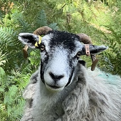
The North York Moors is an upland area in North Yorkshire, England, containing one of the largest expanses of heather moorland in the United Kingdom. The North York Moors National Park was designated in 1952, through the National Parks and Access to the Countryside Act 1949. The National Park covers an area of 554 square miles.

To the east the area is clearly defined by the impressive cliffs of the North Sea coast. The northern and western boundaries are defined by the steep scarp slopes of the Cleveland Hills edging the Tees lowlands and the Hambleton Hills above the Vale of Mowbray. To the south lies the broken line of the Tabular Hills and the Vale of Pickering.

Four roads cross the moors from north to south. In the east the A171 joins Whitby and Scarborough. Further inland, the A169 runs between Pickering and Whitby. More centrally, a minor road departs from the A170 at Keldholme and passes through Castleton before joining the A171 which connects Whitby and Guisborough. The most westerly route is the B1257 connecting Helmsley to Stokesley. The A170 from Thirsk to Scarborough marks the southern boundary of the moors area.

The Esk Valley Line is an east-west branch line rail link from Whitby to Middlesbrough in the north, and the North Yorkshire Moors steam railway runs from Pickering to Grosmont with a link to Whitby.

The cyclists in the 2018 Tour de Yorkshire passed through a section of the Moors.

Getting Started

From forests and fields of heather to market towns and a stunning coast line, the North York Moors National Park is vast. It's highly suitable for dark sky astronomy. The best practice is to incorporate their website into your planning. The recommended starting point is here: https://www.northyorkmoors.org.uk/visiting/see-and-do.

When to Go

It's stunning year round and weather is always a factor. It will be a heavily travelled area on bank holidays and during the summer months.

Dog Info

Leashed dogs are welcome.


Resources

  • wikipedia

  • Hiking Trails (22)
  • Reviews (7)
  1. 1
    Applegath Holiday Cottage
    ★ ★ ★ ★ ★ DIFFICULT 13.4 mi
  2. 2
    Seavey Hill
    ★ ★ ★ ★ ★ DIFFICULT 11.5 mi
  3. 3
    Applegarth Holiday Cottage
    ★ ★ ★ ★ ★ DIFFICULT 17.0 mi
  4. 4
    Falling Foss Waterfall
    ★ ★ ★ ★ ★ DIFFICULT 14.9 mi
  5. 5
    Falling Foss Waterfall
    ★ ★ ★ ★ DIFFICULT 12.7 mi
  6. 6
    Falling Foss Waterfall
    ★ ★ ★ ★ ★ DIFFICULT 12.6 mi
  7. 7
    Falling Foss Waterfall
    ★ ★ ★ ★ DIFFICULT 14.6 mi
  8. 8
    Seavey Hill via Farndale Railway
    ★ ★ ★ ★ DIFFICULT 18.5 mi
  9. 9
    Clay Bank Top via Green Lane
    ★ ★ ★ ★ DIFFICULT 12.1 mi
  10. 10
    Oakham Wood via Bottoms Lane
    ★ ★ ★ EASY 4.2 mi
    user_profile
    vss 3 years, 8 months ago
    Beautiful section of the Coast to Coast route
    ★ ★ ★ ★ ★

    user_profile
    ianmccoid 2 months, 2 weeks ago
    Falling Foss Waterfall
    ★ ★ ★

    user_profile
    alanlanders1 1 year, 8 months ago
    Track (13/09/2020, 08:28:29)
    ★ ★ ★ ★

    user_profile
    Tony 1 year, 8 months ago
    Mutton Scalp, BirkBrow, Path to Margrove
    ★ ★ ★ ★ ★

    user_profile
    Tony 1 year, 8 months ago
    Mutton Scalp, BirkBrow, Path to Margrove
    ★ ★ ★ ★ ★

    user_profile
    Craig 1 year, 11 months ago
    Carlton bank to Kildale
    ★ ★ ★ ★

    user_profile
    Bob 2 years, 10 months ago
    New Track 23/07/2019 10:01:16
    ★ ★ ★ ★ ★

  • Web App

    • Map
    • Find Trails
    • Upload
  • Resources

    • Hiking & Backpacking
    • Offroad
    • Hunting
    • Mountain Biking
    • Backcountry Skiing
    • Fishing
    • Map Catalog
    • Help & Forums
  • Purchase

    • Individuals
    • Professional
    • Outside+
    • Volunteer
    • Gifts
  • Company

    • Blog
    • Podcast
    • Jobs
    • Diversity
    • Partnerships
    • Media
  • Gaia GPS - Trail maps for every adventure

    Follow Us

    Download on the App Store Get it on Google Play

© Trailbehind Inc. - All Rights Reserved.

  Privacy • Terms

Outside Inc Logo

© 2022 Outside Interactive, Inc.

Outside Inc Logo