Mount Sanitas and Sanitas Valley Loop
Overview
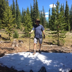
The iconic hike up historic Mt. Sanitas! If you want a steep, challenging ridge hiking experience with a rewarding summit and epic perspective of Boulder, this is the trail for you. This lung-busting hike takes you along the Southern ridge, complete with mirage-like false summits and spectacular rest stop viewpoints aplenty. This trail is mostly exposed to the elements, so hike early or late if hot, and plan for some sun protection. Bring plenty of water and some snacks too. Ice loves to linger all over in the cooler seasons, so be careful of your footing or bring microspikes/traction.
This loop experience is quite steep on ascent and descent, with loose rock and a scrambling feel at times. For trail runners, it would be best to hike this one first to get a true feel of the terrain. Many stair steps await with logs, railroad ties, and boulders painstakingly situated to help assist, but it is still a steep grade!
To begin the loop, leave Centennial Trailhead by crossing the road. Cross under the park shelter, and you'll encounter a few route options. You'll want all the "LEFTs", which will turn you North/Northwest straight on to the ridge trail and up to the top! The beginning is a good indicator of how most of the hike is. If it seems to strenuous, I'd recommend picking another hike. Too many options to not have fun in Boulder!
Once you finally reach the summit views and have had a good break, continue over the other side of the summit (towards Boulder) and you'll find the steep, loose, and fast descent down into the valley. Some areas have more loose/jagged rock than others, and none of them are good spots to fall, so watch your step! Once you find your way down in the valley, continue downhill on the very large gravel path back to the original split and park shelter. From there, cross the road back to the Centennial Trailhead.
Getting Started
Centennial Trailhead:
From Boulder, head WEST on Mapleton Avenue towards the foothills. Centennial Trailhead is a small yet clearly marked parking lot on the left as the road changes names from Mapleton Ave to Sunshine Canyon Drive. If you start heading up canyon, you've most likely passed it. The trailhead is very busy all year, so plan other nearby parking options just in case.
Dogs:
Dogs are allowed on this trail, but NOT on Lion's Lair Trail
Bikes:
No bikes are allowed on this trail
Traction:
Microspikes/Traction highly recommended seasonally due to thick ice/snow
Taking Children
This is a very committing and steep hike for kids, with plenty of ways to slip/trip/fall/scrape throughout. I'd recommend another option unless you have been on this trail before or feel you and your child's abilities are adequate. It would not be fun to carry a kid down this, let alone up! YMMV, I'd say 2.5 out of 10.
Sights to See
Rate this Hike
★★★★★


Public Tracks