meta

Ralston Peak via Hwy 50

based on 138 tracks & routes #10 hike out of 86 in
3.0 mi
Distance
1 hrs 5 min
Time
terrain
2,759 ft
Elev Gain

Overview

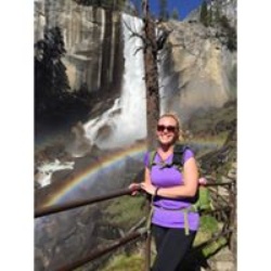
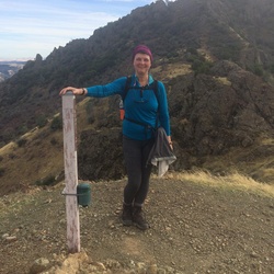
This is a moderately strenuous out-and-back climb into Desolation Wilderness. You're rewarded with views of Desolation and Lake Tahoe. Total distance is only six miles, but it climbs 2800 feet to a 9200 ft summit -- nearly 1000 ft/mile. Ignore the laughable auto-text above that says 3 miles and 1 hour. Hiking only 3 miles would leave you at the summit - needing helicopter extraction. And I don't know any hikers, no matter how well conditioned, who can climb that elevation gain while maintaining that pace!

Getting Started

The Ralston Peak trailhead on Highway 50 is marked and a right turn into the parking area if you approach it from the East. It's a difficult turn off coming from the West. Signage is for Camp Sacramento, which is on the other side of the highway. There's space for maybe 15 cars at the highway, and then a 4x4 road leads to the trailhead proper, 1/4 mile further up. There's parking for a few 4x4s up there as well.

Taking Children

I'm not sure how many young children are up for a 2800 foot climb! If they are, most of the trail is pretty approachable, not much in the way of cliffs and dropoffs. Since it's in the Caldor Burn scar, it could be a good opportunity to talk to kids about the impact of wildfire.


    Rate this Hike

    user_profile
    1 year, 6 months ago
    You already know it's a challenging climb - 2800 feet to Ralston Peak elev 9239. You probably already know this was an area heavily impacted by the Caldor burn in 2021. So the hike is a great opportunity to get up-close-and-personal with the impact of the burn. The early part of the hike goes through a very hot area of the burn. The trees are turned into blackened matchsticks, and the ground is completely scorched. After about a half mile or so, you transition into more typical forest burn - scorched trees still sporting brown needles, and some deerbrush remaining on the ground, with some ground plants now returning. There's a lot of work going on in the Hwy 50 corridor - tree removal and ongoing work at Sierra at Tahoe. Through the first half of the hike, you may hear the sounds of heavy machinery working. (I hiked on a weekday.) The hike provides great views of the work happening at Sierra at Tahoe. The entire West Bowl is now pretty much denuded of trees - this will change the skiing experience considerably: there will be more skiing lines, and also more view lines into Desolation wilderness. But I digress. For the second part of the hike, you're now climbing in earnest. You move up and away from the 50 corridor, and now you're looking *down* on the ski area. There's a brief section where you overlook the cut where horsetail falls is, but sadly no view of the falls itself, which I was hoping for on this hike. Then it's up and the final scramble to the summit. The trail is scantily marked, but using your trail-finding skills you should be able to keep to the trail line without much trouble. Not too much in the way of loose rock, and I only needed to use my hands once or twice. At the summit you're rewarded with an expansive view of Desolation Wilderness, Pyramid Peak, Mt. Tallac, and of course Tahoe itself. Now that it's shoulder season, there's not much traffic on the trail. I saw one other hiker the entire way, and the signature book at the peak only collected four or five names on Sunday. Difficult, but not extreme.
    ★ ★ ★ ★

    user_profile
    3 years, 10 months ago
    I’ve been on this trail quite a few times over the years. But this is my first hike on this trail in over two years. And it is DEFINITELY a nice one that brings me back. As well, it is a fairly challenging trail. This makes it good training for other climbs elsewhere (think Shasta and Whitney), as well as a good hike for general fitness. One thing I DID notice this go-around is that some work has been done on some sections of this trail since my last hike here. Specifically, steps have been made at some of the steeper sections. This helps to make the descent a whole lot less treacherous. As of May 25, there is still snow on the ground for around the last half mile and 400 vertical feet of climbing. But this is nothing too serious. It can easily be negotiated even without microspikes. There are no dangerous icy spots. And post holing is not too much of an issue. You sink into the snow just enough to make coming down safe and relatively speedy. On the other hand, if you REALLY don’t want to hike on snow, I suspect that this part of the trail will be largely (if not entirely) clear within the next two weeks. If not, hiking on snow should at least be avoidable. So come on out and hike! This is one you won’t regret.
    ★ ★ ★ ★ ★

    user_profile
    8 months, 4 weeks ago
    ★ ★

    user_profile
    4 years, 8 months ago
    ★ ★ ★ ★ ★


Public Tracks

user_profile
kemmers7 4 years, 9 months ago
Ralston Peak
4th July hike. Still snow in places
user_profile
kemners7 4 years, 9 months ago
Ralston Peak
4th July hike. Still snow in places
user_profile
rjharo85 7 months, 1 week ago
Ralston Peak
9/8/23 9:54:24 am Ascent W/Mindy
user_profile
Trese Owens 5 years, 6 months ago
Ralston x2
Ralston peak x2
user_profile
carissa 2 years, 9 months ago
user_profile
downiekathryn 2 years, 11 months ago
user_profile
Samhill 2 years, 11 months ago
user_profile
samanthacfu 3 years, 4 months ago
user_profile
pburke77 3 years, 9 months ago
user_profile
chelsierossell 3 years, 9 months ago
user_profile
mattstorm8314 3 years, 10 months ago
user_profile
stephen.got.lost 3 years, 10 months ago
user_profile
Sabi 4 years, 1 month ago
user_profile
Kayla Moreland 4 years, 7 months ago
user_profile
jsalmonpv 4 years, 7 months ago
user_profile
stefaniebrunswick 4 years, 7 months ago
user_profile
louann039 5 years, 6 months ago
user_profile stars
SF Bay Area 5 years, 9 months ago
user_profile
krameryan 5 years, 10 months ago
user_profile
Tahoe Ogul 6 years, 7 months ago
user_profile
Michael Ranta 6 years, 7 months ago
user_profile
carmen.casey 6 years, 8 months ago
user_profile
Tom Holt 8 years, 10 months ago