Chute Lake via Kettle Valley Rail Trail and Adra Tunnel Bypass Trail
17.6 mi
Distance
10 hrs 11 min
Time
terrain
1,998 ft
Elev Gain
Rate this Hike
★★★★★

Public Tracks

TCT Multi-Use: KVR (Naramata to Chute Lake 28 km)
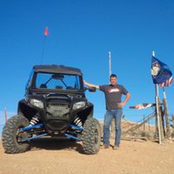
Important: You will almost certainly encounter motorized vehicles along the route, particularly ATVs and dirt bikes, which could be travelling at high speeds. Degraded trail surfaces have many parts of the trail quite challenging for hikers and cyclists. Users should come prepared for sandy conditions. Please see the Trails BC web site for "Equipment Tips".

TCT Multi-Use: KVR (Naramata to Chute Lake 28 km)
Important: You will almost certainly encounter motorized vehicles along the route, particularly ATVs and dirt bikes, which could be travelling at high speeds. Degraded trail surfaces have many parts of the trail quite challenging for hikers and cyclists. Users should come prepared for sandy conditions. Please see the Trails BC web site for "Equipment Tips".

KVR Naramata / Chute Lake / Gravel
Statistics computed from imported data<br><br>Distance: 17.6 miles<br>Minimum Elevation: 1969 feet<br>Maximum Elevation: 3914 feet<br>Total climb: 1945 feet<br>Total descent: 0 feet

TCT Multi-Use: KVR (Naramata to Chute Lake 28 km)
Statistics computed from imported data<br><br>Distance: 17.6 miles<br>Minimum Elevation: 1969 feet<br>Maximum Elevation: 3914 feet<br>Total climb: 1945 feet<br>Total descent: 0 feet