United States
›
Arizona
›
Grand Canyon-Parashant National Monument
›
Mule Point Pond via BLM-1048

Mule Point Pond via BLM-1048(edit)

based on 4 tracks & routes   |   |  
DIFFICULT
   #68 hike out of 95 in Grand Canyon-Parashant National Monument   |   
DIFFICULT
link Copy Link email Email directions Driving Directions
  • GPX
  • KML

12.7 mi
Distance

7 hrs 55 min
Time
terrain
289 ft
Elev Gain

Overview

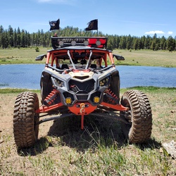
This is a moderate one way trail in Grand Canyon-Parashant National Monument.

This trail goes by North Whitmore Point Pond and Mule Point Pond.


    Rate this Hike

    ★★★★★


Public Tracks

user_profile
Bill Chubick 3 years, 3 months ago
Untitled Path

Elevation Profile

Seasonal Popularity

Nearby Hiking Trails

  1. Toroweap Photopoint via County Highway 5
    ★ ★ ★ DIFFICULT 45.6 mi
  2. Toroweap Point via County Highway 5
    ★ ★ ★ DIFFICULT 82.6 mi
  3. Cold Spring Wash Pond via County Highway 5
    ★ ★ ★ DIFFICULT 75.2 mi
  4. Cold Spring Wash Pond via County Highway 5
    ★ ★ ★ DIFFICULT 72.9 mi
  5. Cold Spring Wash Pond via County Highway 5
    ★ ★ ★ ★ ★ DIFFICULT 66.4 mi
  6. Mule Point Pond via Nutter Twists Road and BLM-1048
    ★ ★ ★ ★ ★ DIFFICULT 29.5 mi
  7. Toroweap Photopoint via County Highway 5
    ★ ★ ★ DIFFICULT 45.2 mi
  8. Toroweap Photopoint via County Highway 5
    ★ ★ ★ DIFFICULT 32.6 mi
  9. Empey Pond via County Highway 5 and County Highway 103
    ★ ★ ★ DIFFICULT 89.9 mi
  10. Sinkhole Pond
    ★ ★ ★ ★ ★ MODERATE 6.0 mi