Agua Caliente Hill via Agua Caliente
Overview
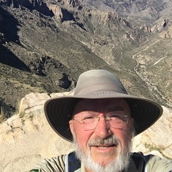
This is a moderate to difficult out and back trail to Agua Caliente Hill in Coronado National Forest. Close to town, great workout, beautiful desert to grassland hike. Decent trail, the last part has some loose rock with steep climb. Definitely a winter hike, even in the winter a sunny day means it'll be a warm hike. Nice views into Agua Caliente Canyon, which is another way to get to the top of Agua Caliente Hill. The top is a good place to catch your breath, eat something and get a power nap. No power nap this time, bees were buzzing around and beeing annoying. Bees were abundant since the manzanita were blooming. And surprisingly starting to see wildflowers, a little early, several decent stands of poppies. Also shared the trail with a roadrunner, mule deer and javelina. As an aside, the sign at the junction with the FS road that takes you to Agua Caliente Canyon is incorrect. Says 1.5 miles to the top, which it's closer to 2 miles, and says 3 miles to the trailhead, I had 2.6 miles.
Getting Started
Park in trailhead parking lot https://goo.gl/maps/MHJczHvwBkkdGY7Q9
Taking Children
Dogs and children are allowed. Dogs will probably have an easier time than the kids. Since it is an out and back you can make it as long or short as you want. Many people hike to the Cat Track Tank which is about 1.7 miles one way. After the rains you can find water in many drainages along the trail, fun for both dogs and kids. The beginning of the hike has some large steps up which could be bothersome for shorter legs.
Sights to See
Rate this Hike
★★★★★


Public Tracks