United States
›
Colorado
›
White River National Forest
›
Ute Trail and CR 142

Ute Trail and CR 142(edit)

based on 8 tracks & routes   |   |  
DIFFICULT
   #392 hike out of 642 in White River National Forest   |   
DIFFICULT
link Copy Link email Email directions Driving Directions
  • GPX
  • KML

15.7 mi
Distance

9 hrs 7 min
Time
terrain
705 ft
Elev Gain

Overview

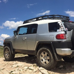
This is a difficult one way trail in White River National Forest.


    Rate this Hike

    ★★★★★


Public Tracks

user_profile
David Baraloto 56 years, 4 months ago
ADAMS LAKE
user_profile
Trevor Hoggatt 56 years, 4 months ago
ADAMS LAKE

Elevation Profile

Seasonal Popularity

Nearby Hiking Trails

  1. White River National Forest Hike
    ★ ★ ★ ★ EASY 2.2 mi
  2. Deep Creek Overlook via Coffee Pot Road
    ★ ★ ★ DIFFICULT 27.1 mi
  3. Heart Lake Dam via CR 141
    ★ ★ ★ EASY 2.4 mi
  4. Coffee Pot Campground via Coffee Pot Road
    ★ ★ ★ DIFFICULT 28.9 mi
  5. CR 142
    ★ ★ MODERATE 6.2 mi
  6. Transfer Trail
    ★ ★ MODERATE 5.8 mi
  7. White Owl Lake Campground via White Owl Road
    ★ ★ MODERATE 6.0 mi
  8. Supply Basin Dam via Transfer Trail
    ★ ★ DIFFICULT 20.4 mi
  9. Supply Basin Lake via Ute Trail and CR 142
    ★ ★ DIFFICULT 15.1 mi
  10. Supply Basin Lake via Ute Trail and County Highway 142
    ★ ★ DIFFICULT 17.4 mi