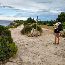
meta

Mt Tamahunga

based on 67 tracks & routes
6.8 mi
Distance
3 hrs 27 min
Time
terrain
1,411 ft
Elev Gain

Overview

This is a moderate one way trail in Auckland.

This trail goes by Northland Peninsula.


    Rate this Hike


Public Tracks

user_profile
ArtsySpring5214 9 years, 11 months ago
Mt Tamahunga (Te Hikoi O Te Kiri)
11 km http://www.teararoa.org.nz/auckland/mt-tamahunga-te-hikoi-o-te-kiri-track
user_profile
LushCompass6747 7 years, 1 month ago
TeAraroaTrail_asRoute.gpx
468.40298 km to 479.35815 km 11 km
user_profile
LushCompass6747 7 years, 1 month ago
TeAraroaTrail_asRoute.gpx
468.40298 km to 479.35815 km 11 km
user_profile
LushCompass6747 7 years, 1 month ago
TeAraroaTrail_asRoute.gpx
468.40298 km to 479.35815 km 11 km
user_profile
Magdalena Hoerst 4 years, 5 months ago
Mt Tamahunga (Te Hikoi O Te Kiri)
465.8533 km to 476.8084 km
user_profile
SlimHarbor7283 7 years, 11 months ago
user_profile
CheeryDelta4037 7 months, 2 weeks ago
user_profile
David Harris 6 years, 5 months ago
NZ
11 km
user_profile
LushCompass6747 7 years, 1 month ago
user_profile
J.R. Robinson 7 years, 2 months ago
user_profile
HappyBasin6009 7 years, 2 months ago