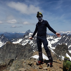
Stujack Pass via Mount Pugh Trail
4.5 mi
Distance
1 hrs 37 min
Time
terrain
3,947 ft
Elev Gain
Overview
This is a difficult one way trail to Stujack Pass in Mount Baker-Snoqualmie National Forest.
Sights to See
Rate this Hike
★★★★★

Public Tracks

Mt. Pugh
Bearings:
- Whitehorse (289 T; 15 miles)
- 3 Fingers (278 T; 15 miles)
- Dickerman (219T; 7 miles)
- Sloan (167 T; 7 miles)
- Black (119T; 9 miles)
- Glacier (97 T; 12 miles)
- Whitechuck (337 T; 5 miles)
Notes:
- Lake Metan is the final water source on the trail
- Trail turns into a scramble route after Stujack Pass (not suitable for pets)

Northwest Region - WA Hike
https://connect.garmin.com/modern/activity/23563914622