United States
›
Colorado
›
Arapaho National Forest
›
Zoom and Chainsaw Loop

Zoom and Chainsaw Loop(edit)

based on 13 tracks & routes   |   |  
EASY
   #109 hike out of 256 in Arapaho National Forest   |   
EASY
link Copy Link email Email directions Driving Directions
  • GPX
  • KML

3.2 mi
Distance

1 hrs 48 min
Time
terrain
636 ft
Elev Gain

Overview

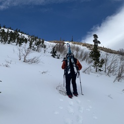
This is a easy loop trail in Arapaho National Forest.


    Rate this Hike

    ★★★★★


Public Tracks

user_profile
TripleBlackDogs 2 months, 3 weeks ago
Track (2/24/26, 13:47:36)
user_profile
marjan56 1 year, 7 months ago
Fraser-Iko/Zoom/Chainsaw loop (aspen)
user_profile
Jay Jackson 8 years, 3 months ago
County Road 72 to County Highway 725, Grand County, CO, USA

Elevation Profile

Seasonal Popularity

Nearby Hiking Trails

  1. Fraser River Trail
    ★ ★ ★ EASY 3.4 mi
  2. Tipperary Creek and Spruce Creek
    ★ ★ ★ MODERATE 5.5 mi
  3. Tipperary Creek
    ★ ★ ★ ★ DIFFICULT 11.4 mi
  4. Boreas Pass
    ★ ★ ★ ★ DIFFICULT 152.0 mi
  5. Deadhorse Loop
    ★ ★ ★ ★ MODERATE 7.1 mi
  6. Flume Loop
    ★ ★ ★ ★ EASY 4.5 mi
  7. County Highway 742 and Byers peak road
    ★ ★ ★ ★ MODERATE 5.8 mi
  8. Blue Sky Trail and Vasquez Loop
    ★ ★ ★ EASY 3.5 mi
  9. Mount Nystrom Trail Head Loop via King Creek Road and County Highway 73
    ★ ★ ★ MODERATE 5.1 mi
  10. Soda Spring via US 40 and Trough Road
    ★ ★ ★ DIFFICULT 67.7 mi