Mendoza Peak
6.5 mi
Distance
3 hrs 0 min
Time
terrain
1,893 ft
Elev Gain
Overview
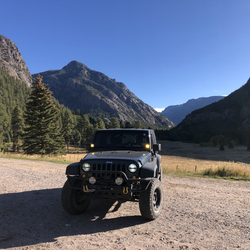
This is a moderate one way trail in Uncompahgre National Forest.
This trail goes by Stony Mountain and Mendota Peak.
This is an alternate route for Stony Mountain.
Rate this Hike
★★★★★
Public Tracks

GOVERNOR BASN
Statistics computed from imported data<br><br>Distance: 5.8 miles<br>Minimum Elevation: 35707 feet<br>Maximum Elevation: 40127 feet<br>Total climb: 4577 feet<br>Total descent: 2218 feet

Governor Basin 2.5
This trail is a combination of Governor Basin rated 2.0 and Sydney Basin rated 2.5. Very scenic plus a tippy spot to get your heart rate up a bit.