Pilot Mountain Loop via Mountain Trail
8.9 mi
Distance
4 hrs 44 min
Time
terrain
1,115 ft
Elev Gain
Overview
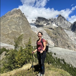
This is a difficult loop trail to Pilot Mountain in Pilot Mountain State Park.
This trail goes by Pinnacle Hotel Road Parking Lot/ Mountain Trail, Corridor Trail trailheads and Pilot Mountain State Park Campground.
Rate this Hike
★★★★★

Public Tracks

Pilot Mountain Loop
Park at the base of the mountain by the park office in the parking area. The trailhead for Grindstone Trail is just opposite and can be reached by a short few steps and crossing the park road. Take the trail to the right that is blue and white blazed. The first section can be a little boggy after some rain. The trail starts gently uphill as a singletrack before passing a stone hut (and some additional parking spots) and crossing the park road to bear left. Soon after the trail forks with the Pilot Creek trail heading right and the Grindstone Trail heading straight on but bearing right. At this point the track widens, passes a campground that can be seen below and starts a steady climb uphill. After a short way, the trail forks with a sign marked for the Mountain Trail with red blazes and Grindstone Trail to continue straight on. It continues climbing up and around the mountain before eventually reaching a junction with Ledge Springs Trail. There is a bench here and an information board displaying the park map and an enlarged section showing the mountain section more clearly. Keep left to stay on Grindstone Trail. This next section continues the climb and once one reaches the steps, this is the steepest hardest part of the trail to reach the upper parking lot. On the left one will pass some picnic benches and a shelter, on the right a connector trail is seen that links Grindstone Trail with Ledge Springs Trail. Continue to the parking lot. A sunken stone bench with a lookout can be found on the right. Follow the paved wide path around the lot for signs to the Little Pinnacle Overlook. This is a 0.1 mile trail to view the main Mountain plug and on a clear day, well worth a photo. Retrace steps and turn right to head down the paved path to turn left onto Jomeokee Trail. This loops around the Mountain itself and best done in an anticlockwise fashion. The loop itself is about 0.8 miles in length. As the loop closes, take the yellow blazed trail off to the left which is Ledge Springs Trail. This narrow trail skirts the side of the mountain and rock climbers can often be seen setting up their gear. There are some steep stone steps to navigate around to follow the trail before it evens up and continues its skirt around the mountain. Eventually it intersects with Grindstone Trail. Retrace steps on Grindstone Trail for about a mile to meet the Mountain Trail on the left. Take Mountain Trail which is a wide track to start with though narrows as it navigates around the mountain to more wooded terrain. This trail is shared with mountain bikers. The route is a little undulating to start with before descending down to an intersection with Corridor trail (a section of the Mountains to Sea trail). This is marked by a signpost though the Corridor trail itself is only noticeable as a name on the white blaze. Mountain Trail continues flush with the mountain but take the Corridor trail right. This trail comes out onto Pinnacle Hotel Rd and opposite the horse parking area (the alternative start in case of parking difficulties). Turn left and follow the road on the grass verge before turning back into the woods to start Grassy Ridge Trail. This trail is shared with horses and is a wide track that is grassy in sections and undulating. As one starts this section, looking through the trees to the left, Pilot Mountain itself becomes visible. The first part of Grassy Ridge Trail is quiet and then as it bends towards the highway 52, the road traffic noise becomes more noticeable. An intersection is reached where a right turn becomes Sauratown trail, which heads onwards towards Hanging Rock State Park some 22 miles away. Continue straight on. This section of the trail is closed off to horses, and a short while afterwards the Mountain Trail comes in from the left. Continue straight on and after climbing a short part, the parking area at the beginning comes into view before the trail bends to the right and one emerges at the start once again.