Upper Crystal Lake Camp via Crystal Lakes Trail and Crystal Peak Trail
Overview
This is a difficult one way trail to Upper Crystal Lake Camp in Mount Rainier National Park. It is very short, steep, and soft (mostly dirt) with rewarding peaceful views of the lakes and wildflowers or snow.
This trail goes by Lower Crystal Lake Camp, Lower Crystal Lake, Site 1, and Site 2.
Getting Started
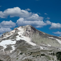
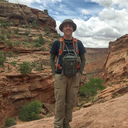
The parking lot for this is easy to miss, as it is just a place to pull off a beyond mile marker 51 or so. This trail is generally significantly less crowded because it's easy to zoom by on the way to other trails. Start off by crossing a wood board traversing a stream and immediately find yourself in the moss covered forest. The terrain is soft dirt, with very few rocks. This trail is steadily steep. Just before a wooden boardwalk structure, it is worthwhile to veer off to the right to get a glimpse of Mt. Rainier on a clear day. Continue along the path to the 1.3 mile mark, where you encounter the junction between Crystal Lakes (left) and Crystal Peaks (right). Stay left and continue upwards. During the warmer seasons you can find wildflowers dotting the path, and animal tracks in the snow in the winter months. Spikes and poles are recommended when accessing this trail in the winter because of the steep grade and ice.
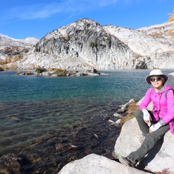
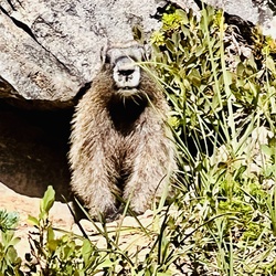
At the 2.3 mile mark, you can either go right to the Lower Crystal Lake with two designated campsites, or go left an additional 0.7 miles to Crystal Lake. Both are beautiful and extremely peaceful. No highway noise can be heard for majority of this trail, just the wind through the peaks. More campsites are available at Crystal Lake. Elk and mountains goats have been seen here, as well as bobcat scat. Enjoy the peacefulness of the lake(s) before heading back the way you came.
If these three miles weren't enough for you, there is also an access point to the PCT that can be seen on a few, but not all maps. On the north side of Crystal lake, take the left fork at a Y that does not continue around the lake up towards Three Way Peak. You will find yourself on a ridgeline with great views of the lake and wildflowers/snow, again depending on the season. This point leaves you just a few hundred feet away from a PCT switchback that will take you to Sourdough Gap. Here, you can see Mount Adams, Mount St. Helens and the valley below. If you want to continue 2.4 miles down the PCT, you will find yourself at Highway 410 at Chinook Pass. Plan accordingly for how far you wish to hike and if you want to car swap with friends so you don't have to go back up and down!
Taking Children
The terrain is soft, short, but very steep. Use your judgement for your child, as this trail gains 2600 feet in 3 miles.
Sights to See
Rate this Hike
★★★★★


Public Tracks