Rose Knob Peak via Jennifer
4.9 mi
Distance
1 hrs 52 min
Time
terrain
2,066 ft
Elev Gain
Overview
This is a difficult one way trail in Lake Tahoe Basin Management Unit.
Rate this Hike
★★★★★
Public Tracks

Rose Knob Peak
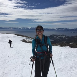
Coming from Hwy 28 and Lake Tahoe, drive up Hwy 431 (Mt. Rose Highway) for a mile or so. Take a left on Fay or Marlette, and follow Jennifer Street to the dead end. You can see the summit of Mt. Rose Knob Peak from you car. Stay out of the drainage, and skin through the trees to the Southeast Ridge. There is good powder skiing in the east facing trees from mid-mountain. If you go beyond this point, you will want to climb to the summit for your next opportunity for good skiing. The drainage does not make for good skiing. Going to the top is highly recommended for the views.
Rose Knob Peak, Incline Village, NV
Alpenglow Festival - women's intermediate backcountry skiing