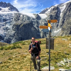
United States
›
Colorado
›
Gunnison National Forest
›
Ruby Road Loop

Ruby Road Loop(edit)

based on 13 tracks & routes   |   |  
DIFFICULT
   #3 hike out of 419 in Gunnison National Forest   |   
DIFFICULT
link Copy Link email Email directions Driving Directions
  • GPX
  • KML

11.1 mi
Distance

5 hrs 34 min
Time
terrain
2,705 ft
Elev Gain

Overview

This is a difficult loop trail in Gunnison National Forest.


    Rate this Hike

    ★★★★★


Public Tracks

user_profile
Henry Malmgren 8 years, 9 months ago
Almost to the top of Mt. Crested Butte
user_profile
WJS1962 8 years, 9 months ago
Mount Crested Butte
user_profile
James Baugh 9 years, 1 month ago
Crested Butte Mountain Resort, Mount Crested Butte, CO, USA

Elevation Profile

Seasonal Popularity

Alternate Routes

  1. Time Table Loop
    ★ ★ ★ ★ ★ EASY 4.0 mi
  2. Aspen Park Road
    ★ ★ ★ ★ MODERATE 5.1 mi

Nearby Hiking Trails

  1. Snodgrass Mountain via Snodgrass Road 590
    ★ ★ ★ ★ ★ EASY 2.9 mi
  2. Strand Hill Trail 556 Loop
    ★ ★ ★ ★ ★ MODERATE 6.5 mi
  3. Snodgrass Road
    ★ ★ ★ ★ ★ EASY 1.5 mi
  4. 590 and Snodgrass Road
    ★ ★ ★ ★ ★ EASY 1.5 mi
  5. Snodgrass Road and Teddy's Trail Loop
    ★ ★ ★ ★ ★ EASY 1.7 mi
  6. Snodgrass Road
    ★ ★ ★ ★ ★ EASY 3.5 mi
  7. Painter Boy
    ★ ★ ★ ★ ★ MODERATE 6.8 mi
  8. Peanut Lake Road Loop
    ★ ★ ★ ★ ★ DIFFICULT 9.2 mi
  9. Meridian Lake
    ★ ★ ★ DIFFICULT 11.4 mi
  10. Oh-Be-Joyful Campground Loop
    ★ ★ ★ ★ ★ DIFFICULT 9.5 mi